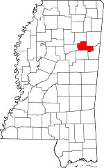
Clay County, Mississippi
Clay County | |
|---|---|
 West Point City Hall at West Point Central City Historic District. | |
 Location within the U.S. state of Mississippi | |
 Mississippi's location within the U.S. | |
| Coordinates: 33°39′N 88°46′W / 33.65°N 88.77°W | |
| Country | |
| State | |
| Founded | 1871 |
| Named for | Henry Clay |
| Seat | West Point |
| Largest city | West Point |
| Area | |
| • Total | 416 sq mi (1,080 km2) |
| • Land | 410 sq mi (1,100 km2) |
| • Water | 5.9 sq mi (15 km2) 1.4% |
| Population (2020) | |
| • Total | 18,636 |
| • Density | 45/sq mi (17/km2) |
| Time zone | UTC−6 (Central) |
| • Summer (DST) | UTC−5 (CDT) |
| Congressional district | 1st |
| Website | www |
Clay County is a county in the U.S. state of Mississippi. The county seat is West Point. As of the 2020 census, 18,636 people lived there.[1]
References[change | change source]
- ↑ "QuickFacts: Clay County, Mississippi". United States Census Bureau. Retrieved January 4, 2024.

