
Jones County, Mississippi
Jones County | |
|---|---|
 Jones County courthouse in Ellisville | |
 Location within the U.S. state of Mississippi | |
 Mississippi's location within the U.S. | |
| Coordinates: 31°37′N 89°10′W / 31.62°N 89.17°W | |
| Country | |
| State | |
| Founded | 1826 |
| Named for | John Paul Jones |
| Seat | Laurel and Ellisville |
| Largest city | Laurel |
| Area | |
| • Total | 700 sq mi (2,000 km2) |
| • Land | 695 sq mi (1,800 km2) |
| • Water | 4.9 sq mi (13 km2) 0.7% |
| Population (2020) | |
| • Total | 67,246 |
| • Density | 96/sq mi (37/km2) |
| Time zone | UTC−6 (Central) |
| • Summer (DST) | UTC−5 (CDT) |
| Congressional districts | 3rd, 4th |
| Website | jonescounty |
Jones County is a county found in the southeast part of the U.S. state of Mississippi. As of the 2020 census, the population was 67,246.[1] Its county seats are Laurel and Ellisville.[2]
References[change | change source]
- ↑ "QuickFacts: Jones County, Mississippi". United States Census Bureau. Retrieved January 4, 2024.
- ↑ "Find a County". National Association of Counties. Archived from the original on 2011-05-31. Retrieved 2011-06-07.
Other websites[change | change source]
Wikimedia Commons has media related to Jones County, Mississippi.
- Jones County, Mississippi - Official website
Municipalities and communities of Jones County, Mississippi, United States | ||
|---|---|---|
| Cities | 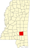 | |
| Towns | ||
| CDPs | ||
| Other communities | ||
| Indian reservation | ||
| Footnotes | ‡This populated place also has portions in an adjacent county or counties | |