
Montour, New York
Montour, New York | |
|---|---|
 Montour Location within the state of New York | |
| Coordinates: 42°20′24″N 76°50′3″W / 42.34000°N 76.83417°W | |
| Country | United States |
| State | New York |
| County | Schuyler |
| Area | |
| • Total | 18.58 sq mi (48.13 km2) |
| • Land | 18.58 sq mi (48.12 km2) |
| • Water | 0.01 sq mi (0.01 km2) |
| Elevation | 741 ft (226 m) |
| Population | |
| • Total | 2,323 |
| • Estimate (2022)[3] | 2,284 |
| • Density | 125.03/sq mi (48.28/km2) |
| Time zone | UTC-5 (Eastern (EST)) |
| • Summer (DST) | UTC-4 (EDT) |
| Area code | 607 |
| FIPS code | 36-48186 |
| GNIS feature ID | 0979233 |
Montour is a town in Schuyler County, New York, United States. The population was 2,323 at the time of the 2020 census.[2] The town is one of two towns in the county named after Catherine Montour. Montour was north of Elmira, New York.
Geography[change | change source]
According to the United States Census Bureau, the area of Montour is 18.6 square miles (48 km2), of which, 18.6 square miles (48 km2) is land and 0.03% is water.
The southern town line is the border of Chemung County.
The town is south of Seneca Lake, one of the Finger Lakes.
New York State Route 14 crosses New York State Route 224 in Montour Falls. NY-14 runs south through the Catharine Creek Valley, following the same route where the Chemung Canal used to be.
Demographics[change | change source]
| Historical population | |||
|---|---|---|---|
| Census | Pop. | %± | |
| 1870 | 1,828 | — | |
| 1880 | 1,771 | −3.1% | |
| 1890 | 1,987 | 12.2% | |
| 1900 | 1,623 | −18.3% | |
| 1910 | 1,608 | −0.9% | |
| 1920 | 1,967 | 22.3% | |
| 1930 | 1,868 | −5.0% | |
| 1940 | 1,774 | −5.0% | |
| 1950 | 1,985 | 11.9% | |
| 1960 | 2,182 | 9.9% | |
| 1970 | 2,324 | 6.5% | |
| 1980 | 2,607 | 12.2% | |
| 1990 | 2,528 | −3.0% | |
| 2000 | 2,446 | −3.2% | |
| 2010 | 2,308 | −5.6% | |
| 2020 | 2,323 | 0.6% | |
| 2022 (est.) | 2,284 | [3] | −1.0% |
| U.S. Decennial Census[4] | |||
Communities and locations in the Town of Montour[change | change source]
- Catharine Creek – a stream flowing northward to Seneca Lake.
- Catharine Creek Wildlife Management Area – A conservation area in the northern part of Montour.
- Dackertown – A hamlet southeast of Montour Falls.
- Montour Falls (formerly "Havana") – Most of the Village of Montour Falls is at the western town line.
- Watkins Glen – A small eastern part of the Village of Watkins Glen is at the western town line by Seneca Lake.
References[change | change source]
- ↑ "2020 U.S. Gazetteer Files". United States Census Bureau. Retrieved March 9, 2024.
- ↑ 2.0 2.1 "Profile of General Population and Housing Characteristics: 2020 Demographic Profile Data (DP-1): Montour town, Schuyler County, New York". United States Census Bureau. Retrieved March 9, 2024.
- ↑ 3.0 3.1 "City and Town Population Totals: 2020—2022". Census.gov. US Census Bureau. Retrieved March 9, 2024.
- ↑ "Census of Population and Housing". Census.gov. Retrieved June 4, 2015.
Other websites[change | change source]
Municipalities and communities of Schuyler County, New York, United States | ||
|---|---|---|
| CDPs | 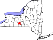 | |
| Towns | ||
| Villages | ||
| Hamlets | ||