
Newton County, Arkansas
Newton County | |
|---|---|
 Boxley Valley in the Upper Buffalo Wilderness | |
 Location within the U.S. state of Arkansas | |
 Arkansas's location within the U.S. | |
| Coordinates: 35°56′08″N 93°13′19″W / 35.935555555556°N 93.221944444444°W | |
| Country | |
| State | |
| Founded | December 14, 1842 |
| Named for | Thomas Willoughby Newton |
| Seat | Jasper |
| Largest city | Jasper |
| Area | |
| • Total | 823 sq mi (2,130 km2) |
| • Land | 821 sq mi (2,130 km2) |
| • Water | 2.3 sq mi (6 km2) 0.3% |
| Population | |
| • Total | 7,225 |
| • Density | 8.8/sq mi (3.4/km2) |
| Time zone | UTC−6 (Central) |
| • Summer (DST) | UTC−5 (CDT) |
Newton County is a county of the U.S. state of Arkansas. As of the 2020 census, the population was 7,225.[1] The county seat is Jasper.[2] It was founded on December 14, 1842.
References[change | change source]
- ↑ 1.0 1.1 "QuickFacts: Newton County, Arkansas". United States Census Bureau. Retrieved August 8, 2023.
- ↑ "Find a County". National Association of Counties. Retrieved 2011-06-07.
Municipalities and communities of Newton County, Arkansas, United States | ||
|---|---|---|
| City | 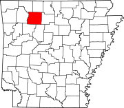 | |
| Town | ||
| Townships | ||
| CDPs | ||
| Other unincorporated communities | ||
