
Overijssel
Overijssel
Overijssel / Oaveriessel | |
|---|---|
Province | |
 Lemelerberg (municipality of Ommen) | |
 Flag  Coat of arms | |
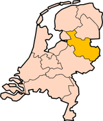 Location | |
 Map | |
| Coordinates: 52°27′N 6°27′E / 52.450°N 6.450°E | |
| Country | Netherlands |
| Established | 1815 |
| Seat | Zwolle |
| Area | |
| • Total | 3,421 km2 (1,321 sq mi) |
| • Land | 3,317 km2 (1,281 sq mi) |
| • Water | 104 km2 (40 sq mi) |
| Highest elevation | 85 m (279 ft) |
| Lowest elevation | −2 m (−7 ft) |
| Population (2023) | |
| • Total | 1,184,000 |
| • Density | 357/km2 (920/sq mi) |
| Website | www |
Overijssel (Latin: Transisalania) is a province of the Netherlands. It is in the central eastern part of the country. The province's name in both Dutch and Latin means "Lands across river IJssel". The capital city of Overijssel is Zwolle. Its biggest city is Enschede. About 1,184,000 people are living in Overijssel (2023).
Geography[change | change source]
Overijssel has Germany to the east. The Achterhoek region of Gelderland lies to the south, the Veluwe region of Gelderland and Flevoland are to the west, and Friesland and the former moors of Drenthe to the north. Overijssel is made of three regions: Kop van Overijssel in the northwest, Salland in the centre of the province, and Twente in the east. Besides the capital Zwolle, the major cities are Almelo, Deventer, Enschede, and Hengelo.
To the southeast, the land is mostly sandy. There are small rivers and brooks cutting through it. Examples for such rivers are Regge and Dinkel. In the northwest, the geology is mostly made of sediments from the Overijsselse Vecht and clay. The northern parts were once covered by veen (bogs) which separated the dryer and more arable south from Drenthe. These bogs have been exploited as fuel to a large degree. Only small patches survive today (Engbertsdijksvenen near Tubbergen, Witteveen (near Haaksbergen, and the Aamsveen (near Enschede). The extreme northwest is dominated by a system of lakes formed by former peat-mining, the Weerribben, which is a valuable wetland.
The highest point in Overijssel is the summit of the Tankenberg, a hill in the municipality of Losser. It is 89 metres (295 ft). The lowest point is in the Mastenbroek Polder near Kampen at 2 metres (6 ft) below sea level.
History[change | change source]
Overijssel was formerly known as Oversticht. In 1336, it was made part of Guelders. It was given to the Bishopric of Utrecht in 1347. Utrecht was known as het Sticht. The Bishops gave the Oversticht to the Emperor Charles V in 1528, who styled himself "Lord of Overijssel". With this, he gave the province its modern name. The people joined with the other Dutch and rebelled against Charles' heir Philip II. Overijssel became governed by the most powerful mayors and lords in the province.
After a brief occupation by the forces of the Bishop of Münster (1672–1674), Overijssel received a new form of government. This granted the stadtholders more power. Widespread resistance against the bigger power throughout the provinces lead to the Batavian Republic in 1795. A centralist government arose and the Netherlands was organised into a series of départements, based on those used by revolutionary France. At first organised into its own département, it was merged with Drenthe in 1798 to form Ouden Ijssel, which was renamed Overijssel in 1801.
The French annexed the Batavian Republic in 1810, and Overijssel was organised into the new French département of Bouches-de-l'Yssel. After the defeat of Napoleon in 1814, the kingdom of the Netherlands and the former province of Overijssel were recreated. Overijssel was briefly occupied by Nazi Germany during World War II from May 1940, until its liberation in April 1945. The Noordoostpolder, which had been laid dry in 1942, was part of Overijssel from 1962 until 1986, when it became part of the newly created province of Flevoland.
Other websites[change | change source]
- Official website

- Map of Province Archived 2005-02-08 at the Wayback Machine
Municipalities of Overijssel (25) | ||
|---|---|---|
 | ||
Municipalities of Kop van Overijssel (4) | ||
|---|---|---|
.svg) | ||
Municipalities of Salland (13) | ||
|---|---|---|
Municipalities of Twente (14) | ||
|---|---|---|
 | ||
 | ||
| International | |
|---|---|
| National | |
| Geographic | |