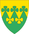
Rakkestad
Rakkestad kommune | |
|---|---|
 | |
 Rakkestad within | |
| Coordinates: 59°22′23″N 11°25′13″E / 59.37306°N 11.42028°E | |
| Country | Norway |
| Administrative centre | Rakkestad |
| Area | |
| • Total | 435 km2 (168 sq mi) |
| • Land | 421 km2 (163 sq mi) |
| • Rank | 227 in Norway |
| Population (2004) | |
| • Total | 7,232 |
| • Rank | 138 in Norway |
| • Density | 17/km2 (40/sq mi) |
| • Change (10 years) | 2.2% |
| Demonym | Raksting[1] |
| Time zone | UTC+01:00 (CET) |
| • Summer (DST) | UTC+02:00 (CEST) |
| ISO 3166 code | NO-3016 |
| Official language form | Bokmål[2] |
| Website | www |
Rakkestad is a municipality in Østfold county, Norway.
Related pages[change | change source]
References[change | change source]
- ↑ "Navn på steder og personer: Innbyggjarnamn" (in Norwegian). Språkrådet.
- ↑ "Forskrift om målvedtak i kommunar og fylkeskommunar" (in Norwegian). Lovdata.no.

