Rochester, Michigan
Rochester, Michigan | |
|---|---|
 Welcome sign to Rochester | |
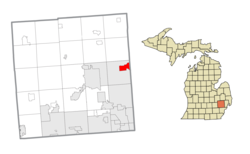
 Location within Oakland County | |
| Coordinates: 42°40′50″N 83°08′02″W / 42.68056°N 83.13389°W | |
| Country | United States |
| State | Michigan |
| County | Oakland |
| Settled | 1817 |
| As village | 1869 |
| Incorporated (city) | 1967 |
| Government | |
| • Type | Mayor–council |
| Area | |
| • City | 3.83 sq mi (9.92 km2) |
| • Land | 3.83 sq mi (9.92 km2) |
| • Water | 0.00 sq mi (0.00 km2) |
| Elevation | 751 ft (229 m) |
| Population | |
| • City | 13,035 |
| • Density | 3,402.51/sq mi (1,313.75/km2) |
| • Metro | 4,296,250 (Metro Detroit) |
| Time zone | UTC-5 (EST) |
| • Summer (DST) | UTC-4 (EDT) |
| ZIP code(s) | 48306–48308 |
| Area code(s) | 248 and 947 |
| FIPS code | 26-69020[3] |
| GNIS feature ID | 0636069[4] |
| Website | Official website |
Rochester is a city in Oakland County in the U.S. state of Michigan. About 13,035 lived here in 2020.[2] It is a northern suburb of Metro Detroit. It is located about 16 miles (25.75 km) north of the city of Detroit.
References[change | change source]
- ↑ "2020 U.S. Gazetteer Files". United States Census Bureau. Retrieved May 21, 2022.
- ↑ 2.0 2.1 "QuickFacts: Rochester city, Michigan". United States Census Bureau. Retrieved February 19, 2024.
- ↑ "U.S. Census website". United States Census Bureau. Retrieved 2008-01-31.
- ↑ U.S. Geological Survey Geographic Names Information System: Rochester, Michigan


