
Saba
Saba | |
|---|---|
Special municipality of the Netherlands | |
 Flag  Coat of arms | |
| Motto(s): | |
| Anthem: "Saba you rise from the ocean" | |
 | |
 Map showing location of Saba relative to Sint Eustatius and Saint Martin. | |
| Coordinates: 17°37′57″N 63°14′15″W / 17.63250°N 63.23750°W | |
| Country | |
| Overseas region | Caribbean Netherlands |
| Incorporated into the Netherlands | 10 October 2010 (dissolution of the Netherlands Antilles) |
| Capital (and largest city) | The Bottom |
| Government | |
| • Lt. Governor | Jonathan Johnson |
| Area | |
| • Total | 13 km2 (5 sq mi) |
| Population (1 January 2022)[2] | |
| • Total | 1,911 |
| • Density | 148/km2 (380/sq mi) |
| Demonym | Saban |
| Languages | |
| • Official | Dutch |
| • Recognised regional | English[3] |
| Ethnicity | |
| • Saban | 26.6 % |
| • Sint Maarten | 15.7 % |
| • American | 10.0 % |
| • other | 47.7 % |
| Time zone | UTC−4 (AST) |
| Calling code | +599-4 |
| ISO 3166 code | BQ-SA, NL-BQ2 |
| Currency | United States dollar ($) (USD) |
| Internet TLD | |
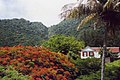
Saba (spoken as "Sah-ba") is the smallest island of the Caribbean Netherlands and the former Netherlands Antilles. It is a special municipality (public body) of the Netherlands. It lies at 17°38′N 63°14′W / 17.633°N 63.233°W. It is mostly made up of Mount Scenery (877 m), the highest point of the Kingdom of the Netherlands. Scenery is a dormant volcano.
Saba has a land area of 13 km² (5 sq. miles). At the 2001 Netherlands Antilles census, 1,349 people lived there. In 2004, about 1,424 people lived there.
Gallery[change | change source]
-
 Hawksbill Turtle
 -
 Saba's airport
 -

-


Notes[change | change source]
References[change | change source]
- ↑ Zaken, Ministerie van Algemene (May 19, 2015). "Waaruit bestaat het Koninkrijk der Nederlanden? – Rijksoverheid.nl". onderwerpen (in Dutch). Retrieved Oct 4, 2021.
- ↑ "Caribisch Nederland; bevolking; geslacht, leeftijd, burgerlijke staat". CBS StatLine. 2022-04-28. Retrieved 2022-08-14.
- ↑ English can be used in relations with the government. "Invoeringswet openbare lichamen Bonaire, Sint Eustatius en Saba" (in Dutch). wetten.nl. Retrieved 2012-10-14.
- ↑ "BQ – Bonaire, Sint Eustatius and Saba". ISO. Archived from the original on 17 June 2016. Retrieved 29 August 2014.
- ↑ "Delegation Record for .BQ". IANA. 20 December 2010. Archived from the original on 29 May 2012. Retrieved 30 December 2010.
Other websites[change | change source]
![]() Media related to Saba at Wikimedia Commons
Media related to Saba at Wikimedia Commons
- Saba's Tourist Bureau homepage
- Saba Conservation Foundation's homepage
- Saba Ferry Dawn II
- Saba (N.A.): Bos en nationale parken. 54pp. Archived 2016-03-03 at the Wayback Machine
- Saba University School of Medicine
| International | |
|---|---|
| National | |
| People | |