
Sumner, Mississippi
Sumner, Mississippi | |
|---|---|
 Tallahatchie County Courthouse in Sumner | |
 Location of Sumner, Mississippi | |
 Sumner, Mississippi Location in the United States | |
| Coordinates: 33°58′12″N 90°22′11″W / 33.97000°N 90.36972°W | |
| Country | United States |
| State | Mississippi |
| County | Tallahatchie |
| Area | |
| • Total | 0.55 sq mi (1.42 km2) |
| • Land | 0.55 sq mi (1.42 km2) |
| • Water | 0.00 sq mi (0.00 km2) |
| Elevation | 141 ft (43 m) |
| Population | |
| • Total | 278 |
| • Density | 505.45/sq mi (195.18/km2) |
| Time zone | UTC-6 (Central (CST)) |
| • Summer (DST) | UTC-5 (CDT) |
| ZIP code | 38957 |
| Area code | 662 |
| FIPS code | 28-71520 |
| GNIS feature ID | 0678403 |
Sumner is a town in Tallahatchie County, Mississippi. 278 people lived here at the 2020 census. Sumner is one of the two county seats of Tallahatchie County.
It is located on the west side of the county and the Tallahatchie River, which runs through the county north-south.
References[change | change source]
- ↑ "2020 U.S. Gazetteer Files". United States Census Bureau. Retrieved July 24, 2022.
- ↑ "Profile of General Population and Housing Characteristics: 2020 Demographic Profile Data (DP-1): Sumner town, Mississippi". United States Census Bureau. Retrieved February 10, 2024.
Municipalities and communities of Tallahatchie County, Mississippi, United States | ||
|---|---|---|
| City | 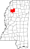 | |
| Towns | ||
| Village | ||
| Unincorporated communities | ||
| Ghost towns | ||
| Footnotes | ‡This populated place also has portions in an adjacent county or counties | |