Vichada Department
Vichada Department
Departamento del Vichada | |
|---|---|
| Motto(s): Tierra de hombres para hombres sin tierra Land of men for men without land[1] | |
 Vichada shown in red | |
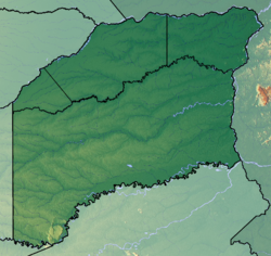
 Topography of the department | |
| Coordinates: 6°11′N 67°28′W / 6.183°N 67.467°W | |
| Country | |
| Region | Orinoquía Region |
| Established | July 5, 1913 |
| Capital | Puerto Careño |
| Area | |
| • Total | 100,242 km2 (38,704 sq mi) |
| Population (2013)[4] | |
| • Total | 68,575 |
| • Density | 0.68/km2 (1.8/sq mi) |
| Time zone | UTC-05 |
| ISO 3166 code | CO-VID |
| Municipalities | 4 |
| Website | www.gobvichada.gov.co |
Vichada Department is a department of Colombia in South America. The capital and largest town is Puerto Carreño.
Vichada borders Venezuela to the north and east.
Municipalities[change | change source]

References[change | change source]
- ↑ "Conservación en Situ" (in Spanish). condesan.org. Archived from the original (doc) on 2012-04-25. Retrieved 2011-10-26.
- ↑ "Geografía e Historia: Ubicación, Extencion y Límites". Gobernación del Vichada.[permanent dead link]
- ↑ Kline, Harvey F. (2012). "Vichada, Department of". Historical Dictionary of Colombia. Lanham, Maryland: Scarecrow Press. p. 493. ISBN 978-0-8108-7813-6.
- ↑ "DANE". Archived from the original on November 13, 2009. Retrieved February 13, 2013.


