
Clay County, Alabama
Clay County | |
|---|---|
 Clay County Courthouse in Ashland | |
 Location within the U.S. state of Alabama | |
 Alabama's location within the U.S. | |
| Coordinates: 33°16′20″N 85°51′40″W / 33.2722°N 85.8611°W | |
| Country | |
| State | |
| Founded | December 7, 1866 |
| Named for | Henry Clay |
| Seat | Ashland |
| Largest city | Lineville |
| Area | |
| • Total | 606 sq mi (1,570 km2) |
| • Land | 604 sq mi (1,560 km2) |
| • Water | 2.0 sq mi (5 km2) 0.3% |
| Population | |
| • Total | 14,236 |
| • Density | 23/sq mi (9.1/km2) |
| Time zone | UTC−6 (Central) |
| • Summer (DST) | UTC−5 (CDT) |
| Website | alabamaclaycounty |
Clay County is a county of the US state of Alabama. As of 2020 the population was 14,236.[1] Its county seat is Ashland. It is a prohibition or dry county, which means alcoholic drinks cannot be sold, except in the cities of Ashland and Lineville.[2]
History[change | change source]
Clay County was formed on December 7, 1866 from land taken from Randolph and Talladega County. Its name is in honor of Henry Clay, famous American statesman, member of the United States Senate from Kentucky and United States Secretary of State. Clay County is one of only three counties in Alabama to have no U.S. Highways in its boundaries.
During the Desert Shield/Storm conflict, Clay County had more soldiers serving per capita than any other county in the United States.[3]
Geography[change | change source]
According to the United States Census Bureau, the county has a total area of 606 square miles (1,570 km2), of which 604 square miles (1,560 km2) is land and 2.0 square miles (5.2 km2) (0.3%) is water.[4]
Major highways[change | change source]
Rail[change | change source]
- CSX Transportation
- Norfolk Southern Railway
Border counties[change | change source]
- Cleburne County, Alabama – north
- Randolph County, Alabama – east
- Tallapoosa County, Alabama – south
- Coosa County, Alabama – southwest
- Talladega County, Alabama – west
National protected area[change | change source]
- Talladega National Forest (part)
Cities and towns[change | change source]
Notable natives[change | change source]
- Hugo Black (1886–1971), born in Harlan, served as an associate justice of the U.S. Supreme Court from 1937 until 1971
- LaFayette L. Patterson (1888–1987), born near Delta, served three terms in the U.S. Congress from 1928 to 1933
- Byron Lavoy Cockrell (1935–2007), born in Lineville, rocket scientist and engineer
- Bob Riley (b. 1944), Alabama's 52nd governor, native of Ashland
Places of interest[change | change source]
Clay County is home to parts of Cheaha State Park in the Talladega National Forest and Lake Wedowee on the eastern boundary. The Pinhoti Trail system Archived 2009-04-09 at the Wayback Machine weaves its way through the Talladega National Forest to Mt. Cheaha, the highest point in Alabama. Hikers along the trail may see some of the local wildlife, including whitetail deer, wild turkey, and the rare bald eagle.
References[change | change source]
- ↑ 1.0 1.1 "QuickFacts: Clay County, Alabama". United States Census Bureau. Retrieved August 8, 2023.
- ↑ "Wet Cities". Alabama ABC Board. Retrieved May 3, 2024.
- ↑ Small Town Historic Markers, Alabama Tourism Department, retrieved 2011-02-02
- ↑ "2010 Census Gazetteer Files". United States Census Bureau. August 22, 2012. Retrieved August 22, 2015.
Municipalities and communities of Clay County, Alabama, United States | ||
|---|---|---|
| City | 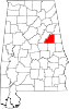 | |
| Town | ||
| CDPs | ||
| Unincorporated communities | ||
| International | |
|---|---|
| National | |
| Geographic | |