Adams, Massachusetts
Adams, Massachusetts | |
|---|---|
 | |
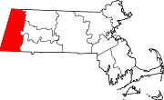
 Location in Berkshire County and the state of Massachusetts. | |
| Coordinates: 42°37′27″N 73°07′05″W / 42.62417°N 73.11806°W | |
| Country | United States |
| State | Massachusetts |
| County | Berkshire |
| Settled | 1762 |
| Incorporated | 1778 |
| Government | |
| • Type | Board of Selectmen Representative town meeting |
| Area | |
| • Total | 23.0 sq mi (59.5 km2) |
| • Land | 22.9 sq mi (59.3 km2) |
| • Water | 0.08 sq mi (0.2 km2) |
| Elevation | 799 ft (244 m) |
| Population (2020)[1] | |
| • Total | 8,166 |
| • Density | 360/sq mi (140/km2) |
| Time zone | UTC-5 (Eastern) |
| • Summer (DST) | UTC-4 (Eastern) |
| ZIP code | 01220 |
| Area code | 413 |
| FIPS code | 25-00555 |
| GNIS feature ID | 0619415 |
| Website | town |
Adams is a town in northern Berkshire County, Massachusetts, United States. It is part of the Pittsfield, Massachusetts Metropolitan Statistical Area. The population was 8,166 at the 2020 census.[1]
References[change | change source]
- ↑ 1.0 1.1 "QuickFacts: Adams town, Berkshire County, Massachusetts". United States Census Bureau. Retrieved March 4, 2024.


