Burlington, Iowa
Burlington, Iowa
Shoquoquon Flint Hills | |
|---|---|
City | |
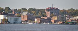
 Downtown Burlington from Mississippi River | |
 Location in the state of Iowa | |
| Coordinates: 40°48′29″N 91°6′57″W / 40.80806°N 91.11583°W | |
| Country | United States |
| State | |
| County | Des Moines |
| Founded | 1833 |
| Area | |
| • Total | 15.17 sq mi (39.29 km2) |
| • Land | 14.41 sq mi (37.32 km2) |
| • Water | 0.76 sq mi (1.98 km2) |
| Elevation | 696 ft (185 m) |
| Population | |
| • Total | 23,982 |
| • Density | 1,664.49/sq mi (642.68/km2) |
| • Demonym | Burlingtonian |
| Time zone | UTC−6 (CST) |
| • Summer (DST) | UTC−5 (CDT) |
| ZIP code | 52601 |
| Area code | 319 |
| FIPS code | 19-09550 |
| GNIS feature ID | 0454995 |
| Website | burlingtoniowa.org |
Burlington is a city in Des Moines County, Iowa, United States. The population was 23,982 at the 2020 census.[2]
References[change | change source]
- ↑ "2020 U.S. Gazetteer Files". United States Census Bureau. Retrieved March 16, 2022.
- ↑ 2.0 2.1 "Burlington city, Iowa". United States Census Bureau. Retrieved November 3, 2023.
Other websites[change | change source]
Wikimedia Commons has media related to Burlington, Iowa.
- Official City Website Archived 2007-07-24 at the Wayback Machine
- Burlington Public Library
