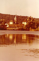
Dampierre-sur-le-Doubs
- Asturianu
- 閩南語 / Bân-lâm-gú
- Català
- Cebuano
- Deutsch
- Ελληνικά
- English
- Español
- Esperanto
- Euskara
- Français
- Italiano
- Kurdî
- Latina
- Magyar
- Bahasa Melayu
- Nederlands
- Нохчийн
- Occitan
- Oʻzbekcha / ўзбекча
- Piemontèis
- Polski
- Português
- Slovenčina
- Српски / srpski
- Srpskohrvatski / српскохрватски
- Svenska
- Татарча / tatarça
- Українська
- Vèneto
- Tiếng Việt
- Winaray
- 粵語
- 中文
From Simple English Wikipedia, the free encyclopedia
Dampierre-sur-le-Doubs | |
|---|---|
 | |
| Coordinates: 47°28′32″N 6°43′59″E / 47.4756°N 6.7331°E / 47.4756; 6.7331 | |
| Country | France |
| Region | Bourgogne-Franche-Comté |
| Department | Doubs |
| Arrondissement | Montbéliard |
| Canton | Bavans |
| Intercommunality | Pays de Montbéliard Agglomération |
| Government | |
| • Mayor (2020–2026) | Yanick Génin |
| Area 1 | 3.16 km2 (1.22 sq mi) |
| Population (Jan. 2019)[1] | 452 |
| • Density | 140/km2 (370/sq mi) |
| Time zone | UTC+01:00 (CET) |
| • Summer (DST) | UTC+02:00 (CEST) |
| INSEE/Postal code | 25191 /25420 |
| Elevation | 301–458 m (988–1,503 ft) |
| 1 French Land Register data, which excludes lakes, ponds, glaciers > 1 km2 (0.386 sq mi or 247 acres) and river estuaries. | |
Dampierre-sur-le-Doubs is a commune. It is in Bourgogne-Franche-Comté in the Doubs department in east France.
References[change | change source]
- ↑ "Populations légales 2019". The National Institute of Statistics and Economic Studies. 29 December 2021.


