Dolná Krupá
Appearance
Dolná Krupá | |
|---|---|
Village | |
 Mansion in Dolná Krupá | |
Location of Dolná Krupá in the Trnava Region | |
| Coordinates: 48°29′N 17°33′E / 48.483°N 17.550°E | |
| Country | Slovakia |
| Region | Trnava |
| District | Trnava |
| Population (2004-12-31) | |
| • Total | 2,229 |
| Postal code | 919 65 |
| Area code | +421-033 |
| Car plate | TT |
| Website | www.dolnakrupa.sk |
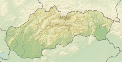
Dolná Krupá is a village in the Trnava Region of Slovakia. It is in the Danubian Hills at around 12 km from the city of Trnava.
The important sights in the village are:
- the Saint Andrew church, built in 1807–1811
- the Dolná Krupá mansion.
Wikimedia Commons has media related to Dolná Krupá.


