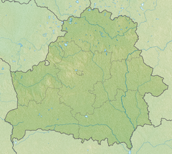
Drūkšiai
| Drūkšiai | |
|---|---|
 Lake Drūkšiai in Lithuania, at Tilžė village | |
| Coordinates | 55°37′17″N 26°36′21″E / 55.62139°N 26.60583°E |
| Primary outflows | Prorva |
| Catchment area | 613 km2 (237 sq mi) |
| Basin countries | Lithuania, Belarus |
| Surface area | 44.79 km2 (17.29 sq mi) |
| Average depth | 7.6 m (25 ft) |
| Max. depth | 33.3 m (109 ft) |
| Surface elevation | 141.6 m (465 ft) |
Drūkšiai is a lake on the border between Belarus and Lithuania. The lake was formed by glacier activity. The greatest depth is in the central part of the lake, the southern part is shallow. Due to its great depth, most of the lake does not freeze in winter. There are 95 sorts of plants, 25 sorts of fish and more than 140 sorts of birds.
Lake water was used for cooling the Ignalina nuclear power plant.[1]
References[change | change source]
- ↑ "Drūkšiai". www.vle.lt (in Lithuanian). Retrieved 2023-08-23.


