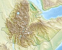
Erta Ale
| Erta Ale | |
|---|---|
 Erta Ale in 2011 | |
| Highest point | |
| Elevation | 613 m (2,011 ft)[1] |
| Listing | List of volcanoes in Ethiopia |
| Coordinates | 13°36′N 40°40′E / 13.600°N 40.667°E[2] |
| Geography | |
| Parent range | Erta Ale Range |
| Geology | |
| Mountain type | Shield volcano |
| Last eruption | 2005 to 2019 (Ongoing)[3] |
Erta Ale is a 613 metres (2,011 ft) shield volcano in Ethiopia.[4] The name means Smoking Mountain.[5] It is one of the most active volcanoes in Africa.[6]
References[change | change source]
- ↑ "Erta Ale, Ethiopia". Volcano World. Oregon State University. Retrieved 2007-08-08.
- ↑ "Erta Ale". Global Volcanism Program. Smithsonian Institution. Retrieved 2009-02-22.
- ↑ "Erta Ale volcano". 12 June 2019.
- ↑ "Erta Ale, Ethiopia". Peakbagger.com. Retrieved 4 November 2019.
- ↑ Schrader, Robert (6 June 2019). "The Story Behind Erta Ale Volcano, Ethiopia's "Door to Hell"". TripSavvy. Retrieved 4 November 2019.
- ↑ "Visiting Erta Ale volcano: the 'hike to hell and back'". Atlas & Boots. 6 December 2017. Retrieved 4 November 2019.
Other websites[change | change source]
 Media related to Erta Ale at Wikimedia Commons

