
File:Pfaelzerwaldkarte Flussgebiete Moder.png
Size of this preview: 800 × 538 pixels. Other resolutions: 320 × 215 pixels | 640 × 431 pixels | 1,024 × 689 pixels | 1,280 × 861 pixels | 2,284 × 1,537 pixels.
Original file (2,284 × 1,537 pixels, file size: 5.04 MB, MIME type: image/png)
| This is a file from the Wikimedia Commons. Information from its description page there is shown below. Commons is a freely licensed media file repository. You can help. |
Summary
| Description |
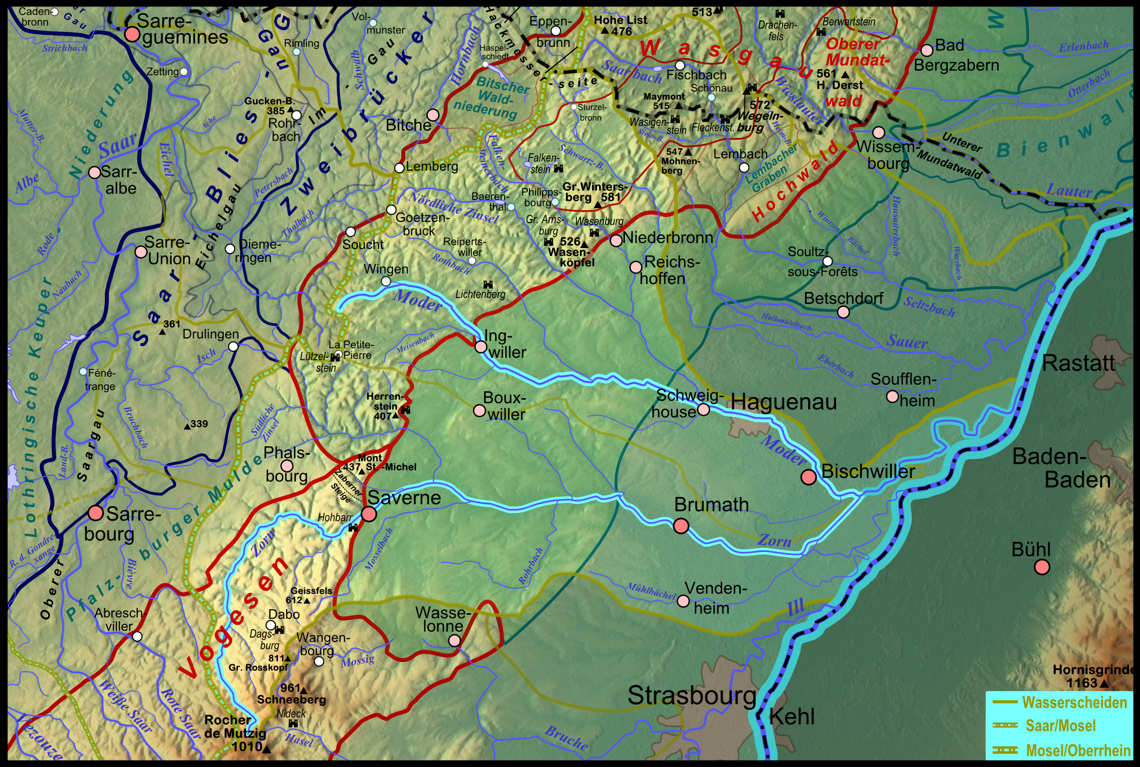
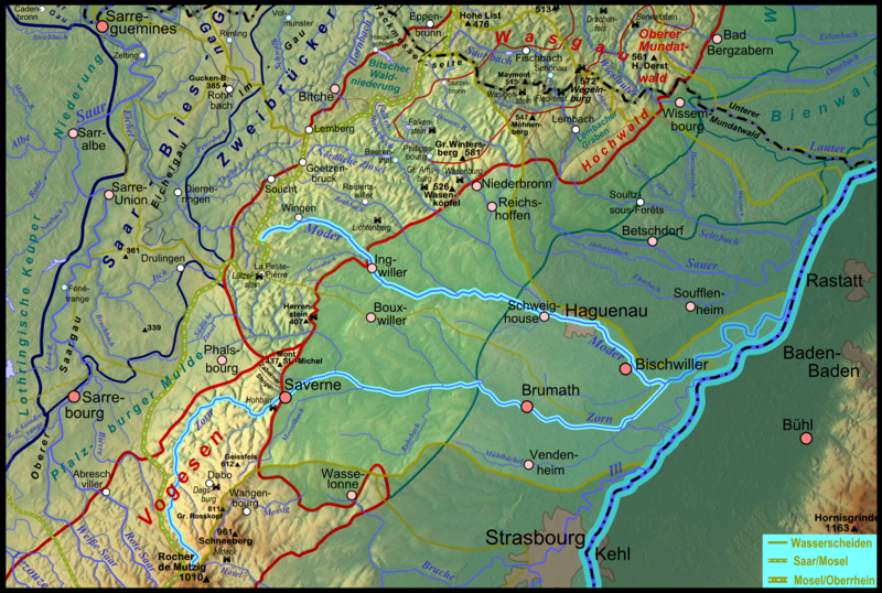
Deutsch: Karte des Flussgebietes des elsässischen Rhein- Nebenflusses Moder; der südliche Hauptarm Zorn ist ebenfalls hervorgehoben. Français : Carte du bassin hydrographique de la Moder en Alsace. |
| Date | |
| Source |
Own work
|
| Author | Elop |
| Other versions |
|
Licensing

|
Permission is granted to copy, distribute and/or modify this document under the terms of the GNU Free Documentation License, Version 1.2 or any later version published by the Free Software Foundation; with no Invariant Sections, no Front-Cover Texts, and no Back-Cover Texts. A copy of the license is included in the section entitled GNU Free Documentation License. |
File history
Click on a date/time to view the file as it appeared at that time.
| Date/Time | Thumbnail | Dimensions | User | Comment | |
|---|---|---|---|---|---|
| current | 20:45, 18 January 2012 | | 2,284 × 1,537 (5.04 MB) | Elop | == Summary == {{Information |Description ={{de|1=Karte des Flussgebietes der elsässischen de:Rhein- Nebenflusses Moder; der südliche Hauptarm Zorn ist ebenfalls hervorgehoben.}} |Sourc |
File usage
The following page uses this file:
Global file usage
The following other wikis use this file:
- Usage on als.wikipedia.org
- Usage on ceb.wikipedia.org
- Usage on de.wikipedia.org
- Usage on en.wikipedia.org
- Usage on fr.wikipedia.org
- Usage on he.wikipedia.org
- Usage on sr.wikipedia.org
- Usage on www.wikidata.org
- Usage on zh.wikipedia.org