
Moder (river)
| Moder | |
|---|---|
 Map of the Moder's drainage basin | |
| Location | |
| Country | France |
| Physical characteristics | |
| Source | |
| - location | Moderfeld |
| - coordinates | 48°53′44″N 07°18′58″E / 48.89556°N 7.31611°E |
| - elevation | 330 m (1,080 ft) |
| Mouth | |
| - location | Rhine |
| - coordinates | 48°50′13″N 08°06′12″E / 48.83694°N 8.10333°E |
| - elevation | 115 m (377 ft) |
| Length | 82.1 km (51.0 mi) |
| Basin size | 1,720 km2 (660 sq mi) |
| Discharge | |
| - average | 16.6 m3/s (590 cu ft/s) |
| Basin features | |
| Tributaries | |
| - right | Zorn |
The Moder is a river in Alsace, in north-eastern France. It is a left-side tributary of the Rhine river.
Geography[change | change source]
The Moder river has a length of 82.1 km (51.0 mi), and a drainage basin with an area of 1,720 km2 (664 sq mi).[1]
Its average yearly discharge (volume of water which passes through a section of the river per unit of time) is 16.6 m3/s (590 cu ft/s) at Auenheim.
Course[change | change source]
The Moder starts in the Vosges mountains in the place called Moderfeld in the commune of Zittersheim, (Bas-Rhin department), at an altitude of about 330 m (1,083 ft).[2] From here, the Moder flows to the north and then turns to the southeast; in the final part, the river flows to the northeast.
The Moder river flows within the Grand Est region, the Bas-Rhin department and the following communes ː Zittersheim, Wingen-sur-Moder, Wimmenau, Ingwiller, Menchhoffen, Schillersdorf, Obermodern-Zutzendorf, Schalkendorf, La Walck, Pfaffenhoffen, Uberach, Niedermodern, Dauendorf, Ohlungen, Schweighouse-sur-Moder, Haguenau, Kaltenhouse, Oberhoffen-sur-Moder, Bischwiller, Rohrwiller, Drusenheim, Sessenheim, Dalhunden, Stattmatten, Auenheim, Fort-Louis, Rœschwoog, Neuhaeusel.
Finally, the Moder river flows into the Rhine river in Neuhaeusel.[3]
Main tributaries[change | change source]
The main tributaries of the Moder river areː
- Left tributary
- Right tributary
- Zorn - 96.7 km;[6]
Gallery[change | change source]
-
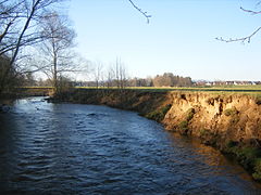
 The Moder in Drusenheim.
 -
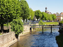
 The Moder in Haguenau.
 -
 The Zinsel du Nord in Mertzwiller.
 -
 The Zorn in Saverne.


Related pages[change | change source]
References[change | change source]
- ↑ "La Moder (A3--0100)" (in French). SANDRE - Portail national d'accès aux référentiels sur l'eau. Archived from the original on 3 March 2016. Retrieved 28 December 2017.
- ↑ "Source de la Moder" (in French). Géoportail. Retrieved 28 December 2017.
- ↑ "Confluence de la Moder" (in French). Géoportail. Retrieved 28 December 2017.
- ↑ "Ruisseau le Rothbach (A31-0200)" (in French). SANDRE - Portail national d'accès aux référentiels sur l'eau. Archived from the original on 4 March 2016. Retrieved 28 December 2017.
- ↑ "La Zinsel du Nord (A32-0200)" (in French). SANDRE - Portail national d'accès aux référentiels sur l'eau. Archived from the original on 4 March 2016. Retrieved 28 December 2017.
- ↑ "La Zorn (A34-0200)" (in French). SANDRE - Portail national d'accès aux référentiels sur l'eau. Archived from the original on 3 March 2016. Retrieved 28 December 2017.