
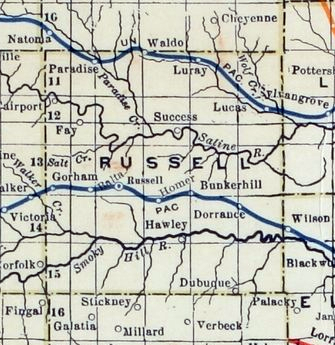
File:Stouffer's Railroad Map of Kansas 1915-1918 Russell County.png
No higher resolution available.
Stouffer's_Railroad_Map_of_Kansas_1915-1918_Russell_County.png (335 × 345 pixels, file size: 214 KB, MIME type: image/png)
| This is a file from the Wikimedia Commons. Information from its description page there is shown below. Commons is a freely licensed media file repository. You can help. |
Summary
| Description | |
| Date | |
| Source | http://www.kansasmemory.org/item/227380 (Kansas Historical Society) |
| Author | J.W. Stouffer, download / crop / cleanup from larger map by Steve Meirowsky |
Licensing
This media file is in the public domain in the United States. This applies to U.S. works where the copyright has expired, often because its first publication occurred prior to January 1, 1929, and if not then due to lack of notice or renewal. See this page for further explanation.
|
 | |
 |
This image might not be in the public domain outside of the United States; this especially applies in the countries and areas that do not apply the rule of the shorter term for US works, such as Canada, Mainland China (not Hong Kong or Macao), Germany, Mexico, and Switzerland. The creator and year of publication are essential information and must be provided. See Wikipedia:Public domain and Wikipedia:Copyrights for more details.
|
File history
Click on a date/time to view the file as it appeared at that time.
| Date/Time | Thumbnail | Dimensions | User | Comment | |
|---|---|---|---|---|---|
| current | 10:18, 29 May 2013 | | 335 × 345 (214 KB) | Sbmeirow | Fix Level |
| 17:53, 28 May 2013 |  | 335 × 345 (212 KB) | Sbmeirow | User created page with UploadWizard |
File usage
The following 2 pages use this file:
Global file usage
The following other wikis use this file:
- Usage on en.wikipedia.org