Harding Township, New Jersey
Harding Township, New Jersey | |
|---|---|
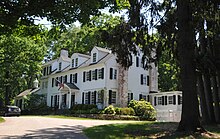
 Hartley Farms | |
 Location of Harding Township in Morris County highlighted in red (right). Inset map: Location of Morris County in New Jersey highlighted in orange (left). | |
 Census Bureau map of Harding Township, New Jersey | |
| Coordinates: 40°44′16″N 74°29′43″W / 40.737825°N 74.495335°W[1][2] | |
| Country | |
| State | |
| County | |
| Incorporated | September 1, 1922 |
| Named for | Warren G. Harding |
| Government | |
| • Type | Township |
| • Body | Township Committee |
| Area | |
| • Total | 20.57 sq mi (53.28 km2) |
| • Land | 20.05 sq mi (51.94 km2) |
| • Water | 0.52 sq mi (1.34 km2) 2.51% |
| • Rank | 140th of 565 in state 9th of 39 in county[1] |
| Elevation | 367 ft (112 m) |
| Population | |
| • Total | 3,871 |
| • Rank | 417th of 565 in state 36th of 39 in county[6] |
| • Density | 193.0/sq mi (74.5/km2) |
| • Rank | 506th of 565 in state 39th of 39 in county[6] |
| Time zone | UTC−05:00 (EST) |
| • Summer (DST) | UTC−04:00 (EDT) |
| ZIP Code | |
| Area code(s) | 973[9] |
| FIPS code | 3402729700[1][10][11] |
| GNIS feature ID | 0882195[1][12] |
| Website | www |
Harding Township is a township in Morris County, New Jersey, United States. It is located in the Raritan Valley region within the New York City Metropolitan Area.[13][14][15]
References[change | change source]
- ↑ 1.0 1.1 1.2 1.3 1.4 2019 Census Gazetteer Files: New Jersey Places, United States Census Bureau. Accessed July 1, 2020.
- ↑ US Gazetteer files: 2010, 2000, and 1990, United States Census Bureau. Accessed September 4, 2014.
- ↑ 2012 New Jersey Legislative District Data Book, Rutgers University Edward J. Bloustein School of Planning and Public Policy, March 2013, p. 95.
- ↑ U.S. Geological Survey Geographic Names Information System: Township of Harding, Geographic Names Information System. Accessed March 5, 2013.
- ↑ Total Population: Census 2010 - Census 2020 New Jersey Municipalities, New Jersey Department of Labor and Workforce Development. Accessed December 1, 2022.
- ↑ 6.0 6.1 Population Density by County and Municipality: New Jersey, 2020 and 2021, New Jersey Department of Labor and Workforce Development. Accessed March 1, 2023.
- ↑ Look Up a ZIP Code for New Vernon, NJ, United States Postal Service. Accessed December 2, 2012.
- ↑ Zip Codes, State of New Jersey. Accessed September 11, 2013.
- ↑ Area Code Lookup - NPA NXX for New Vernon, NJ, Area-Codes.com. Accessed September 11, 2013.
- ↑ U.S. Census website, United States Census Bureau. Accessed September 4, 2014.
- ↑ Geographic Codes Lookup for New Jersey, Missouri Census Data Center. Accessed April 1, 2022.
- ↑ US Board on Geographic Names, United States Geological Survey. Accessed September 4, 2014.
- ↑ Snyder, John P. The Story of New Jersey's Civil Boundaries: 1606-1968, Bureau of Geology and Topography; Trenton, New Jersey; 1969. p. 193. Accessed October 26, 2012.
- ↑ Staff. Acts of the One Hundred and Forty-Sixth Legislature of the State of New Jersey, pp. 74-77. New Jersey Secretary of State, 1922. Accessed October 17, 2015. "Chapter 40 - An Act to incorporate the township of Harding, in the county of Morris"
- ↑ Historical Timeline of Morris County Boundaries Archived 2016-12-25 at the Wayback Machine, Morris County Library. Accessed December 24, 2016. "1922, September 1. Harding Township is established from Passaic. The township includes sections Green Village and New Vernon. From PL 1923, p. 587."

