
Knoxville, Arkansas
Knoxville, Arkansas | |
|---|---|
 Location of Knoxville in Johnson County, Arkansas. | |
| Coordinates: 35°22′41″N 93°21′47″W / 35.37806°N 93.36306°W | |
| Country | United States |
| State | Arkansas |
| County | Johnson |
| Government | |
| • Mayor | John Tyson |
| Area | |
| • Total | 3.19 sq mi (8.27 km2) |
| • Land | 3.18 sq mi (8.25 km2) |
| • Water | 0.01 sq mi (0.02 km2) |
| Elevation | 387 ft (118 m) |
| Population (2020) | |
| • Total | 660 |
| • Density | 207.29/sq mi (80.02/km2) |
| Time zone | UTC-6 (Central (CST)) |
| • Summer (DST) | UTC-5 (CDT) |
| ZIP code | 72845 |
| Area code | 479 |
| FIPS code | 05-37300 |
| GNIS feature ID | 2405959[2] |
Knoxville is a town in the US state of Arkansas. There were 660 people living there according to the 2020 census.[3]
References[change | change source]
- ↑ "2020 U.S. Gazetteer Files". United States Census Bureau. Retrieved October 29, 2021.
- ↑ 2.0 2.1 U.S. Geological Survey Geographic Names Information System: Knoxville, Arkansas
- ↑ "Knoxville city, Arkansas". United States Census Bureau. Retrieved September 8, 2023.
Municipalities and communities of Johnson County, Arkansas, United States | ||
|---|---|---|
| Cities | 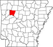 | |
| Town | ||
| CDPs | ||
| Other unincorporated communities | ||