From Simple English Wikipedia, the free encyclopedia
Location of World Heritage Sites within Iran
[1] There are twenty-four World Heritage Sites in Iran as[1]
Template:Nomirror
Site ; named after the World Heritage Committee's official designation[2] Location ; at city, regional, or provincial level and geocoordinatesCriteria ; as defined by the World Heritage Committee[3] Area ; in hectares and acres . If available, the size of the buffer zone has been noted as well. A lack of value implies that no data has been published by UNESCOYear ; during which the site was inscribed to the World Heritage ListDescription ; brief information about the site, including reasons for qualifying as an endangered site, if applicable
Site
Image
Location
Criteria
Area
ha (acre )
Year
Description
Armenian Monastic Ensembles of Iran
West Azerbaijan Province 38°58′44″N 45°28′24″E / 38.97889°N 45.47333°E / 38.97889; 45.47333 Cultural:IrnArm
(ii)(iii)(vi)
2008
[4]
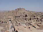
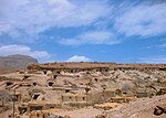
Bam and its Cultural Landscape
Kerman Province 29°07′00″N 58°22′00″E / 29.11667°N 58.36667°E / 29.11667; 58.36667 Cultural:IrnBam
(ii)(iii)(iv)(v)
—
2004
[5]
Bisotun
Kermanshah Province 34°23′18″N 47°26′12″E / 34.38833°N 47.43667°E / 34.38833; 47.43667 Cultural:IrnBis
(ii)(iii)
2006
[6]
Cultural Landscape of Maymand
Kerman Province 30°10′05″N 55°22′32″E / 30.16806°N 55.37556°E / 30.16806; 55.37556 Cultural:IrnCul
(v)
2015
[7]
Gonbad-e Qābus
Golestan Province 37°15′29″N 55°10′08″E / 37.25806°N 55.16889°E / 37.25806; 55.16889 Cultural:IrnGon
(i)(ii)(iii)(iv)
2012
[8]
Golestan Palace
Tehran 35°40′47″N 51°25′13″E / 35.67972°N 51.42028°E / 35.67972; 51.42028 Cultural:IrnGon
(ii)(iii)(iv)
2013
[9]
Lut Desert
Kerman and Sistan and Baluchestan Provinces
30°12′58″N 58°50′20″E / 30.21611°N 58.83889°E / 30.21611; 58.83889
Natural:IrnLut
(vii)(viii)
2016
[10]
The Ensemble of Historical Sassanian Cities in Fars Province (Bishabpur , Firouzabad , Sarvestan )
Fars Province
29°46′39″N 51°34′14″E / 29.77750°N 51.57056°E / 29.77750; 51.57056
Cultural:IrnThePerQan
(ii)(iii)(v)
2018
[11]
Masjed-e Jāmé of Isfahan
Isfahan , Isfahan Province
32°40′11″N 51°41′07″E / 32.66972°N 51.68528°E / 32.66972; 51.68528
Cultural:IrnMas
(ii)
2012
[12]
Naqsh-e Jahan Square
Isfahan , Isfahan Province
32°39′27″N 51°40′40″E / 32.65750°N 51.67778°E / 32.65750; 51.67778
Cultural:IrnMei
(i)(v)(vi)
—
1979
[13]
Pasargadae
Fars Province 30°11′38″N 53°10′02″E / 30.19389°N 53.16722°E / 30.19389; 53.16722 Cultural:IrnPas
(i)(ii)(iii)(iv)
2004
[14]
Persepolis
Fars Province 29°56′04″N 52°53′25″E / 29.93444°N 52.89028°E / 29.93444; 52.89028 Cultural:IrnPer
(i)(iii)(vi)
1979
[15]
Shahr-e Sukhteh
Sistan and Baluchestan Province 30°35′38″N 61°19′40″E / 30.59389°N 61.32778°E / 30.59389; 61.32778 Cultural:IrnPer
(ii)(iii)(iv)
2014
[16]
Sheikh Safi al-din Khānegāh and Shrine Ensemble in Ardabil
Ardabil Province 38°14′55″N 48°17′29″E / 38.24861°N 48.29139°E / 38.24861; 48.29139 Cultural:IrnShe
(i)(ii)(iv)
2010
[17]
Shushtar Historical Hydraulic System
Khuzestan Province 32°01′07″N 48°50′09″E / 32.01861°N 48.83583°E / 32.01861; 48.83583 Cultural:IrnShu
(i)(ii)(v)
2009
[18]
Soltaniyeh
Zanjan Province 36°26′07″N 48°47′48″E / 36.43528°N 48.79667°E / 36.43528; 48.79667 Cultural:IrnSha
(ii)(iii)(iv)
2005
[19]
Susa
Khuzestan Province 32°11′22″N 48°15′22″E / 32.18944°N 48.25611°E / 32.18944; 48.25611 Cultural:IrnSus
(i)(ii)(iii)(iv)
2015
[20]
Tabriz Historic Bazaar Complex
East Azerbaijan Province 38°04′53″N 46°17′35″E / 38.08139°N 46.29306°E / 38.08139; 46.29306 Cultural:IrnTab
(ii)(iii)(iv)
2010
[21]
Takht-e Soleyman
West Azerbaijan Province 36°36′14″N 47°14′06″E / 36.60389°N 47.23500°E / 36.60389; 47.23500 Cultural:IrnTak
(i)(ii)(iii)(iv)(vi)
2003
[22]
Tchogha Zanbil
Khuzestan Province 32°05′00″N 48°32′00″E / 32.08333°N 48.53333°E / 32.08333; 48.53333 Cultural:IrnTch
(iii)(iv)
—
1979
[23]
The Persian Garden
Many Provinces (Fars , Kerman , Razavi Khorasan , Yazd , Mazandaran , and Isfahan Provinces )
Cultural:IrnThePerGar
(i)(ii)(iii)(iv)(vi)
2011
[24]
Persian Qanat
Razavi Khorasan , South Khorasan , Yazd , Kerman , Markazi and Isfahan Provinces
34°17′24″N 58°39′16″E / 34.29000°N 58.65444°E / 34.29000; 58.65444
Cultural:IrnThePerQan
(iii)(iv)
—
2016
[25]
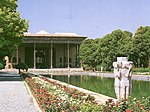
Historic City of Yazd
Yazd , Yazd Province
31°53′50″N 54°22′4″E / 31.89722°N 54.36778°E / 31.89722; 54.36778
Cultural:IrnThePerQan
(iii)(v)
2017
[26]
Caspian Hyrcanian mixed forests
Golestan , Mazandaran and Gilan Provinces
37°25′17.3″N 55°43′27.4″E / 37.421472°N 55.724278°E / 37.421472; 55.724278
Natural:IrnHyr
(ix)
2019
Hyrcanian forest covered some parts of Three provinces of Iran including: Golestan Province: The entirety of the southern and southwestern areas as well as parts of the eastern regions of the Gorgan plain is covered with Hyrcanian forest, totaling an area.[27]


