Matosinhos
Matosinhos | |
|---|---|
 | |
| Coordinates: 41°11′N 8°42′W / 41.183°N 8.700°W | |
| Country | |
| Region | Norte |
| Metropolitan area | Porto |
| District | Porto |
| Parishes | 4 |
| Government | |
| • President | Luísa Salgueiro (PS) |
| Area | |
| • Total | 62.42 km2 (24.10 sq mi) |
| Population (2011) | |
| • Total | 175,478 |
| • Density | 2,800/km2 (7,300/sq mi) |
| Time zone | UTC±00:00 (WET) |
| • Summer (DST) | UTC+01:00 (WEST) |
| Website | http://www.cm-matosinhos.pt |
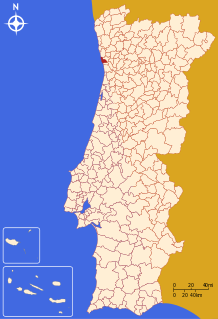
Matosinhos (Portuguese pronunciation: [mɐtuˈziɲuʃ] (![]() listen)) is a city and a municipality in the northern Porto district of Portugal. It bordered in the south by the city of Porto (8 km from the city centre). The population in 2011 was 175,478.[1]
listen)) is a city and a municipality in the northern Porto district of Portugal. It bordered in the south by the city of Porto (8 km from the city centre). The population in 2011 was 175,478.[1]


