Nephi, Utah
Appearance
Nephi, Utah | |
|---|---|
 City sign | |
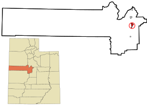
 Location in Juab County and state of Utah | |
| Coordinates: 39°42′33″N 111°49′53″W / 39.70917°N 111.83139°W | |
| Country | United States |
| State | Utah |
| County | Juab |
| Settled | 1851 |
| Named for | Nephi |
| Area | |
| • Total | 4.57 sq mi (11.82 km2) |
| • Land | 4.57 sq mi (11.82 km2) |
| • Water | 0.00 sq mi (0.00 km2) |
| Elevation | 5,128 ft (1,563 m) |
| Population (2020) | |
| • Total | 6,443 |
| • Density | 1,400/sq mi (550/km2) |
| Time zone | UTC−7 (Mountain (MST)) |
| • Summer (DST) | UTC−6 (MDT) |
| ZIP code | 84648 |
| Area code | 435 |
| FIPS code | 49-54220[2] |
| GNIS feature ID | 1443793[3] |
| Website | nephi |
Nephi (/ˈniːfaɪ/ NEE-fy) is a city in Juab County, Utah, United States. It is part of the Provo–Orem metropolitan area. The population was 5,389 at the 2020 census.[4]
References
[change | change source]- ↑ "2019 U.S. Gazetteer Files". United States Census Bureau. Retrieved August 7, 2020.
- ↑ "U.S. Census website". United States Census Bureau. Retrieved 2008-01-31.
- ↑ "US Board on Geographic Names". United States Geological Survey. 2007-10-25. Retrieved 2008-01-31.
- ↑ "Nephi city, Utah". United States Census Bureau. Retrieved July 27, 2023.

