Oxnard Airport
Oxnard Airport Ventura County Army Airfield | |||||||||||
|---|---|---|---|---|---|---|---|---|---|---|---|
 USGS 2006 orthophoto | |||||||||||
| Summary | |||||||||||
| Airport type | Public | ||||||||||
| Owner | County of Ventura | ||||||||||
| Serves | Oxnard, California | ||||||||||
| Elevation AMSL | 45 ft / 14 m | ||||||||||
| Coordinates | 34°12′03″N 119°12′26″W / 34.20083°N 119.20722°W | ||||||||||
| Maps | |||||||||||
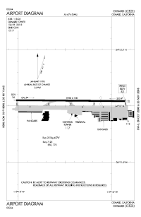
 FAA airport diagram | |||||||||||
| Runways | |||||||||||
| |||||||||||
| Statistics (2010) | |||||||||||
| |||||||||||
Oxnard Airport (IATA: OXR, ICAO: KOXR, FAA LID: OXR) is a county-owned, public airport a mile west of downtown Oxnard, in Ventura County, California.
The airport has not had scheduled passenger service since June 8, 2010.[2]
References[change | change source]
- ↑ FAA Airport Master Record for OXR (Form 5010 PDF). Federal Aviation Administration. Effective April 5, 2012.
- ↑ "United Express plans to end service to Oxnard Airport". Los Angeles Times. March 16, 2010.

