Parque das Nações
Appearance
Parque das Nações | |
|---|---|
|
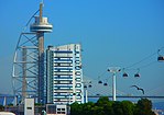
Clockwise: View of the Parque das Nações with Altice Arena; Lisbon Oceanarium; Lisbon Justice Campus; Gare do Oriente; Vasco da Gama Tower; Portugal Pavillion. | |
 | |
| Coordinates: 38°46′05″N 9°05′38″W / 38.768°N 9.094°W | |
| Country | |
| Region | Lisboa |
| Metropolitan area | Lisbon |
| District | Lisbon |
| Municipality | Lisbon |
| Area | |
| • Total | 5.44 km2 (2.10 sq mi) |
| Population (2011) | |
| • Total | 21,025 |
| • Density | 3,900/km2 (10,000/sq mi) |
| Time zone | UTC±00:00 (WET) |
| • Summer (DST) | UTC+01:00 (WEST) |
| Patron | Our Lady of Navigators |
| Website | http://jf-parquedasnacoes.pt/ |
The Parque das Nações (literally: Park of the Nations), is a freguesia (civil parish) of Lisbon, the capital of Portugal.[1] It is located in eastern Lisbon, Parque das Nações is to the east of Olivais, north of Marvila, and south of Loures. In 2018, an estimated 31,000 people live in the area.[2]
References
[change | change source]- ↑ Diário da República. "Law nr. 56/2012, pages 6454-6460" (pdf) (in Portuguese). Retrieved 21 November 2014.
- ↑ Azevedo, Virgílio (May 21, 2018). "Parque das Nações: a cidade de todos os recordes". Expresso. Archived from the original on May 22, 2018. Retrieved May 22, 2018.


