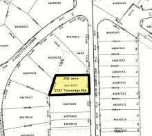
Plat

In the United States, a plat (/plæt/[1] or /plɑːt/)[2] (plan) is a map that shows the parts of a piece of land for where houses and buildings will be built.
After filing a plat, legal descriptions can start using block and lot-numbers instead of calling them portions of sections.[3]
References[change | change source]
- ↑ American Heritage Dictionary, 3rd ed., s.v. "plat."
- ↑ from a letter published in The Gentleman's Magazine, Volume 72, Part 1, London, 1802 [1]: "... many attorneys ought to be whipt for not knowing how to spell; that plot a conspiracy and plat a piece of ground were pronounced exactly alike ..."
- ↑ "City of Corpus". Cctexas.com. Retrieved 2012-12-13.
