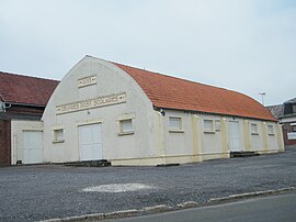
Ronssoy
From Simple English Wikipedia, the free encyclopedia
Ronssoy | |
|---|---|
 | |
| Coordinates: 49°58′58″N 3°09′38″E / 49.9828°N 3.1606°E / 49.9828; 3.1606 | |
| Country | France |
| Region | Hauts-de-France |
| Department | Somme |
| Arrondissement | Péronne |
| Canton | Roisel |
| Area 1 | 7.53 km2 (2.91 sq mi) |
| Population (2006) | 554 |
| • Density | 74/km2 (190/sq mi) |
| Time zone | UTC+01:00 (CET) |
| • Summer (DST) | UTC+02:00 (CEST) |
| INSEE/Postal code | 80679 /80740 |
| Elevation | 100–147 m (328–482 ft) (avg. 149 m or 489 ft) |
| 1 French Land Register data, which excludes lakes, ponds, glaciers > 1 km2 (0.386 sq mi or 247 acres) and river estuaries. | |
Ronssoy is a commune in the Somme department in Picardie in northern France.
Geography[change | change source]
Ronssoy is 11 miles (18 km) north of Saint-Quentin, on the D6 road.
Retrieved from "https://simple.wikipedia.org/w/index.php?title=Ronssoy&oldid=7078835"


