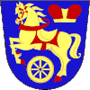
Rozvadov
Rozvadov | |
|---|---|
Municipality | |
 Rozvadov-Waidhaus border crossing | |
| Coordinates: 49°40′6″N 12°33′7″E / 49.66833°N 12.55194°E | |
| Country | |
| Region | Plzeň |
| District | Tachov |
| First mentioned | 1581 |
| Area | |
| • Total | 54.94 km2 (21.21 sq mi) |
| Elevation | 570 m (1,870 ft) |
| Population (2021-01-01)[1] | |
| • Total | 780 |
| • Density | 14/km2 (37/sq mi) |
| Time zone | UTC+1 (CET) |
| • Summer (DST) | UTC+2 (CEST) |
| Postal code | 348 07 |
| Website | www |
Rozvadov (German: Roßhaupt) is a municipality and village in Tachov District in the Plzeň Region of the Czech Republic. It is on the border with Germany.
References[change | change source]
Other websites[change | change source]
Wikimedia Commons has media related to Rozvadov.
- Official website (in Czech)


