Siagne
| Siagne La Siagne (French) | |
|---|---|
 Gorges of the Siagne | |
| Location | |
| Country | France |
| Physical characteristics | |
| Source | |
| - location | near Escragnolles |
| - elevation | 640 m (2,100 ft) |
| Mouth | |
| - location | Mediterranean Sea |
| - coordinates | 43°31′52″N 6°56′54″E / 43.531°N 6.9482°E |
| Length | 44 km (27 mi) |
| Basin size | 512 km2 (198 sq mi) |
| Discharge | |
| - average | Mediterranean Sea |
The Siagne is a short river that flows through the Var and Alpes-Maritimes departments, in southeastern France.
Geography[change | change source]
The Siagne river has a length of 44.3 km (28 mi) and a drainage basin with an area of approximately 556 km2 (215 sq mi).[1]
Its average yearly discharge (volume of water which passes through a section of the river per unit of time) is 8.75 cubic metres per second at Pégomas, near Cannes.
Course[change | change source]
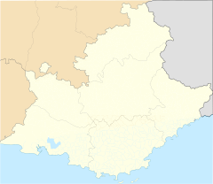
The Siagne starts on the south side of the Audibergue mountain, in the commune of Escragnolles, Alpes-Maritimes department, at an elevation of about 1,367 m (4,485 ft).[2] It then flows to the southwest through the departments of Alpes-Maritimes and Var. For much of its length, it forms the border between the two departments.
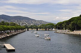
Finally, the river flows into the Mediterranean Sea at the city of Mandelieu-la-Napoule.[3]
The Siagne flows through 2 departments and 13 communes, in one region:[1]
- Alpes-Maritimes department: Escragnolles, Saint-Vallier-de-Thiey, Saint-Cézaire-sur-Siagne, Le Tignet, Peymeinade, Mandelieu-la-Napoule, Auribeau-sur-Siagne, Pégomas, La Roquette-sur-Siagne
- Var: Mons, Callian, Montauroux, Tanneron
Main tributaries[change | change source]
The main tributaries of the Siagne river are:[1]
|
Left tributaries:
|
|
Right tributaries:
|
Gallery[change | change source]
-
Gorges of the Siagne
-
Mouth of the Siagne in Mandelieu-la-Napoule
-
Mouth of the Siagne in Mandelieu-la-Napoule
Related pages[change | change source]
References[change | change source]
- ↑ 1.0 1.1 1.2 "La Siagne (Y55-0400)" (in French). SANDRE - Portail national d'accès aux référentiels sur l'eau. Archived from the original on 3 March 2016. Retrieved 6 October 2016.
- ↑ "Source du Siagne" (in French). Géoportail. Retrieved 6 October 2016.
- ↑ "Embouchure du Siagne" (in French). Géoportail. Retrieved 6 October 2016.


