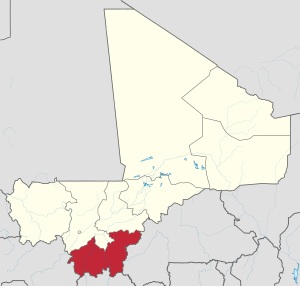
Sikasso Region
Sikasso Region | |
|---|---|
 Location within Mali | |
| Coordinates: 11°11′59″N 7°5′49″W / 11.19972°N 7.09694°W | |
| Country | |
| Capital | Sikasso |
| Area | |
| • Total | 70,280 km2 (27,140 sq mi) |
| Population (2009 census)[1] | |
| • Total | 2,625,919 |
| • Density | 37/km2 (97/sq mi) |
| Time zone | UTC±0 (UTC) |
The Sikasso Region is a region in Mali. Sikasso is the capital of the region. It is the second largest city in Mali. Because of people fleeing the violence in Côte d'Ivoire the city is growing quickly.
Other important towns are Bougouni and Koutiala.
References[change | change source]
- ↑ Resultats Provisoires RGPH 2009 (Région de Sikasso) (PDF) (in French), République de Mali: Institut National de la Statistique, archived (PDF) from the original on 19 September 2012, retrieved 7 May 2013.
