Soledad, California
Soledad, California | |
|---|---|
|
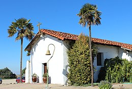
Clockwise: Mission Nuestra Señora de la Soledad; Soledad High School; Mission Soledad. | |
 Location in Monterey County and the state of California | |
| Coordinates: 36°25′29″N 121°19′35″W / 36.42472°N 121.32639°W | |
| Country | United States |
| State | California |
| County | Monterey |
| Incorporated | March 9, 1921[1] |
| Government | |
| • Assemblymember | Dawn Addis (D)[2] |
| • U. S. rep. | Zoe Lofgren (D)[3] |
| Area | |
| • Total | 4.65 sq mi (12.0 km2) |
| • Land | 4.46 sq mi (11.6 km2) |
| • Water | 0.19 sq mi (0.5 km2) 4.09% |
| Elevation | 190 ft (58 m) |
| Population | |
| • Total | 24,925 |
| • Density | 5,588.6/sq mi (2,157.8/km2) |
| Time zone | UTC-8 (Pacific) |
| • Summer (DST) | UTC-7 (PDT) |
| ZIP code | 93960 |
| Area code | 831 |
| FIPS code | 06-72520 |
| Website | cityofsoledad |
Soledad is a city in Monterey County, California, United States.
References[change | change source]
- ↑ "California Cities by Incorporation Date". California Association of Local Agency Formation Commissions. Archived from the original (Word) on November 3, 2014. Retrieved August 25, 2014.
- ↑ 2.0 2.1 "Statewide Database". UC Regents. Archived from the original on February 1, 2015. Retrieved December 8, 2014.
- ↑ "California's 18th Congressional District - Representatives & District Map". Civic Impulse, LLC.
- ↑ "2022 U.S. Gazetteer Files: California". United States Census Bureau. Retrieved November 14, 2022.
- ↑ "Soledad". Geographic Names Information System. United States Geological Survey. Retrieved March 15, 2015.
- ↑ "P1. Race – Soledad city, California: 2020 DEC Redistricting Data (PL 94-171)". U.S. Census Bureau. Retrieved November 14, 2022.


