Tahlequah, Oklahoma
Tahlequah
ᏓᎵᏆ (Cherokee) | |
|---|---|
 Downtown Tahlequah | |
| Motto: "City Of Firsts" | |
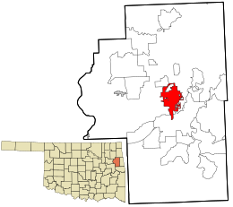
 Location within Cherokee County and the state of Oklahoma | |
| Coordinates: 35°54′41″N 94°58′38″W / 35.91139°N 94.97722°W | |
| Country | |
| State | |
| County | Cherokee |
| Cherokee Nation | founded 1838; second capital city |
| Area | |
| • Total | 12.87 sq mi (33.33 km2) |
| • Land | 12.77 sq mi (33.06 km2) |
| • Water | 0.10 sq mi (0.27 km2) |
| Elevation | 814 ft (248 m) |
| Population (2020) | |
| • Total | 16,209 |
| • Density | 1,269.70/sq mi (490.24/km2) |
| Time zone | UTC-6 (Central (CST)) |
| • Summer (DST) | UTC-5 (CDT) |
| ZIP codes | 74464-74465 |
| Area code(s) | 539/918 |
| FIPS code | 40-72100 [3] |
| GNIS feature ID | 2412028[2] |
| Website | www |
Tahlequah (Pronounced "Tal a Kwa") is the county seat of Cherokee County, Oklahoma, United States. It is at the foot hills of the Ozark Mountains. Tahlequah is also home to Northeastern State University.
Tahlequah is the capital of the Cherokee Nation and the United Keetoowah Band of Cherokee Indians.
References[change | change source]
- ↑ "ArcGIS REST Services Directory". United States Census Bureau. Retrieved September 20, 2022.
- ↑ 2.0 2.1 U.S. Geological Survey Geographic Names Information System: Tahlequah, Oklahoma
- ↑ "Census QuickFacts". United States Census Bureau. Archived from the original on 2014-12-27. Retrieved 2014-12-27.
Wikimedia Commons has media related to Tahlequah, Oklahoma.


