
Tallahatchie County, Mississippi
Tallahatchie County | |
|---|---|
 Tallahatchie County courthouse in Sumner | |
 Location within the U.S. state of Mississippi | |
 Mississippi's location within the U.S. | |
| Coordinates: 33°57′N 90°10′W / 33.95°N 90.17°W | |
| Country | |
| State | |
| Founded | December 31, 1833 |
| Named for | Choctaw word roughly meaning “River of rocks" |
| Seat | Charleston and Sumner |
| Largest city | Charleston |
| Area | |
| • Total | 652 sq mi (1,690 km2) |
| • Land | 645 sq mi (1,670 km2) |
| • Water | 6.9 sq mi (18 km2) 1.1% |
| Population (2020) | |
| • Total | 12,715 |
| • Density | 20/sq mi (7.5/km2) |
| Time zone | UTC−6 (Central) |
| • Summer (DST) | UTC−5 (CDT) |
| Congressional district | 2nd |
Tallahatchie County is a county in the U.S. state of Mississippi. As of the 2020 census, 12,715 people lived there.[1] Its county seats are Charleston and Sumner.[2]
References[change | change source]
- ↑ "QuickFacts: Tallahatchie County, Mississippi". United States Census Bureau. Retrieved January 4, 2024.
- ↑ "Find a County". National Association of Counties. Retrieved 2011-06-07.
Municipalities and communities of Tallahatchie County, Mississippi, United States | ||
|---|---|---|
| City | 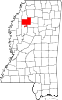 | |
| Towns | ||
| Village | ||
| Unincorporated communities | ||
| Ghost towns | ||
| Footnotes | ‡This populated place also has portions in an adjacent county or counties | |