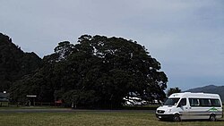
Te Araroa (town)
Te Araroa | |
|---|---|
Town | |
 Te Waha o Rerekohu | |
 | |
| Coordinates: 37°38′S 178°22′E / 37.633°S 178.367°E | |
| Country | New Zealand |
| Region | Gisborne District |
| Ward | Tairāwhiti General Ward |
| Electorate | East Coast |
| Area | |
| • Total | 1.69 km2 (0.65 sq mi) |
| Population (2018 Census)[2] | |
| • Total | 153 |
| • Density | 91/km2 (230/sq mi) |
| Postcode(s) | 4087 |
Te Araroa is a town in the Gisborne Region of the North Island. It is located on State Highway 35 and is 175 kilometers north of Gisborne. It has an area school, medical centre, fire station, takeaways, general store and police station. In 1996, the Hinerupe Marae was destroyed in an electrical fire and was rebuilt and reopened in 2002. In 2006 the Kawakawa Hotel was destroyed in a ravage fire.
References[change | change source]
- ↑ "ArcGIS Web Application". statsnz.maps.arcgis.com. Retrieved 15 January 2023.
- ↑ "Statistical area 1 dataset for 2018 Census". Statistics New Zealand. March 2020. 7015467.
