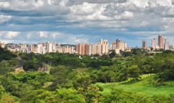
Uberaba
Appearance
Uberaba | |
|---|---|
| Municipality of Uberaba | |
 | |
 Location in Minas Gerais | |
| Coordinates: 19°44′52″S 47°55′55″W / 19.74778°S 47.93194°W | |
| Country | |
| Region | Southeast |
| State | |
| Founded | 2 March 1820 |
| Government | |
| • Mayor | Elisa Gonçalves Araujo (SD) |
| Area | |
| • Total | 4,529.7 km2 (1,748.9 sq mi) |
| Elevation | 823 m (2,700 ft) |
| Population (2021)[1] | |
| • Total | 340,277 |
| • Density | 71/km2 (180/sq mi) |
| Time zone | UTC−3 (BRT) |
| • Summer (DST) | UTC−2 (BRST) |
| Postal Code | 38000-000 |
| Area code | +55 34 |
| HDI (2010) | 0.772 – high[2] |
| Website | www |
Uberaba (Portuguese pronunciation: [ubeˈɾabɐ]) is a city in the state of Minas Gerais, southeast Brazil.[3]
It was founded in 1820 and the city status was granted in 1856.
In 2021 about 340,277 people lived in Uberaba.[4] The name of the city comes from the Tupi language, and means ''bright water''.
It covers an area of 4,529.7 km2 (1,748.9 sq mi).
References
[change | change source]- ↑ IBGE 2020
- ↑ "Archived copy" (PDF). United Nations Development Programme (UNDP). Archived from the original (PDF) on 8 July 2014. Retrieved 1 August 2013.
{{cite web}}: CS1 maint: archived copy as title (link) - ↑ "Uberaba | Brazil | Britannica". www.britannica.com. Retrieved 2022-03-07.
- ↑ giftnily.com (2022-03-07). "There is tupi in Portuguese spoken in Brazil". Giftnily. Retrieved 2022-03-07.


