Yorktown, New York
Yorktown, New York | |
|---|---|
 Amawalk Friends Meeting House | |
| Motto: Progress with Preservation | |
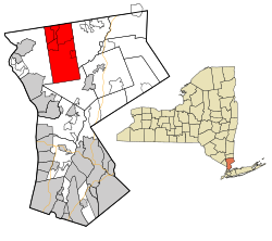
 Location of Yorktown, New York | |
| Coordinates: 41°16′56″N 73°48′33″W / 41.28222°N 73.80917°W | |
| Country | United States |
| State | New York |
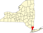
| County | Westchester |
| Area | |
| • Total | 39.35 sq mi (101.90 km2) |
| • Land | 36.76 sq mi (95.21 km2) |
| • Water | 2.59 sq mi (6.70 km2) |
| Elevation | 459 ft (140 m) |
| Population | |
| • Total | 36,569 |
| • Density | 994.8/sq mi (384.1/km2) |
| Time zone | UTC-5 (Eastern (EST)) |
| • Summer (DST) | UTC-4 (EDT) |
| ZIP code | 10598 |
| Area code | 914 |
| FIPS code | 36-84077[3] |
| GNIS feature ID | 0979663[4] |
| Website | yorktownny.org |
Yorktown is a town on the northern border of Westchester County, New York. It is a suburb of the New York City metropolitan area. It is about 38 miles (61 km) north of midtown Manhattan. The population was 36,569 at the 2020 U.S. Census.[2]
References[change | change source]
- ↑ "2020 U.S. Gazetteer Files". United States Census Bureau. Retrieved March 9, 2024.
- ↑ 2.0 2.1 "QuickFacts: Yorktown town, Westchester County, New York". United States Census Bureau. Retrieved March 9, 2024.
- ↑ "U.S. Census website". United States Census Bureau. Retrieved 2008-01-31.
- ↑ "US Board on Geographic Names". United States Geological Survey. 2007-10-25. Retrieved 2008-01-31.


