Romanija
| Romanija | |
|---|---|
| Романија (Serbian Cyrillic) Romanija (Serbian Latin, Croatian) | |
 Landscape in the Romanija mountain | |
| Highest point | |
| Elevation | 1,652 m (5,420 ft) |
| Coordinates | 43°51′36″N 18°40′12″E / 43.86000°N 18.67000°E |
| Geography | |
| Location | Republika Srpska, Bosnia and Herzegovina |
| Parent range | Dinaric Alps |
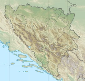
Romanija is a mountain, karst plateau, and area in the Republika Srpska. Many towns are in the area, such as Pale, Sokolac, and Han Pijesak.[1] The highest point on the mountain is Veliki Lupoglav (1,652 m).
A football club from the nearby town of Pale, FK Romanija, is named after the mountain.
References[change | change source]
Wikimedia Commons has media related to Romanija.

