Vaupés River
| Vaupés River Uaupés River | |
|---|---|
 | |
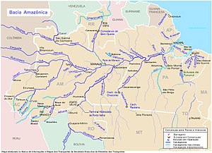
 Vaupés (Uaupés) is in the upper left section | |
| Location | |
| Countries | |
| Physical characteristics | |
| Source | |
| - location | Guaviare Department, Colombia |
| - coordinates | 2°9′1″N 72°57′13″W / 2.15028°N 72.95361°W (approximately) |
| - elevation | 360 m (1,180 ft) |
| Mouth | Rio Negro |
| - coordinates | 0°02′3.06″N 67°16′50.16″W / 0.0341833°N 67.2806000°W |
| - elevation | 67 m (220 ft) |
| Length | 1,050 km (650 mi)[1] |
| Basin size | 64,370.4 km2 (24,853.6 sq mi)[2] |
| Discharge | |
| - location | Amazonas, Brazil (near mouth) |
| - average | 4,344.9 m3/s (153,440 cu ft/s)[2] |
| Discharge | |
| - location | Taracuá, Amazonas |
| - average | 2,757.3 m3/s (97,370 cu ft/s)[2] |
| Discharge | |
| - location | Uaracu, Amazonas |
| - average | 2,452.7 m3/s (86,620 cu ft/s)[2] |
| Discharge | |
| - location | Mitú, Vaupés, Colombia |
| - average | 1,232.4 m3/s (43,520 cu ft/s)[2] |
| Basin features | |
| Tributaries | |
| - right | Papuri, Tiquié |
The Rio Uaupes is a river in Colombia. It forms part of the border between Colombia and Brazil. In Brazil it joins the Papurí River. Both rivers are then called the Uaupés.
References[change | change source]
- ↑ Ziesler, R.; Ardizzone, G.D. (1979). "Amazon River System". The Inland waters of Latin America. Food and Agriculture Organization of the United Nations. ISBN 92-5-000780-9. Archived from the original on 8 November 2014.
- ↑ 2.0 2.1 2.2 2.3 2.4 "Rivers Network".
0°02′03″N 67°16′50″W / 0.0341833°N 67.2806°W
