
Ādaži
Ādaži | |
|---|---|
Town | |
 Center of Ādaži | |
 Ādaži Location in Latvia | |
| Coordinates: 57°05′N 24°19′E / 57.083°N 24.317°E | |
| Country | |
| District | Ādaži District |
| Town rights | 2022 |
| Government | |
| • Chairman of the council | Karīna Miķelsone |
| Area | |
| • Total | 8.8 km2 (3.4 sq mi) |
| Population | |
| • Total | 7,482 |
| • Density | 850/km2 (2,200/sq mi) |
| Time zone | UTC+2 (EET) |
| • Summer (DST) | UTC+3 (EEST) |
| Postal code | LV-2164 |
| Website | adazi.lv |
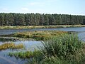
Ādaži (pronunciation: [ˈaː.da.ʒi]) is a town in Latvia with town rights since 2022. It is the center of the Ādaži District. As of 2022, Ādaži had a population of 7,482 people. Ādaži is on small river Vējupe near river Gauja. Lake Mazais Baltezers is to south from the town.
Ādaži was a small village until 1970s (with population of 303 people in 1965).[1] After, a new farming village was built. In 21th-century, Ādaži grew as cottage village, with some food factories.
A big military camp of NATO is to north from the town.[2]
Roads
[change | change source]Roads from Ādaži: Riga—Tallinn (A1), Ādaži-Jaunciems (P1), Lapmeži-Ādaži-Baltezers (V50), Ādaži-Garkalne (V46). The nearest railway stations are Garkalne (5 km) and Carnikava (6 km). The center of Riga is 22 km from Ādaži to south.
Gallery
[change | change source]-
 River Vējupe.
 -
 Living house.
 -
 Bridge over Gauja.
 -
 Culture house.


References
[change | change source]- ↑ Little Latvian Encyclopedia, 1967
- ↑ NATO Secretary General visits Ādaži Military Base in Latvia nato.int
Other websites
[change | change source]- Town site Archived 2021-05-06 at the Wayback Machine
| International | |
|---|---|
| National | |