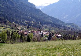
Almens
Almens | |
|---|---|
 | |
| Coordinates: 46°44′N 9°27′E / 46.733°N 9.450°E | |
| Country | Switzerland |
| Canton | Graubünden |
| District | Hinterrhein |
| Government | |
| • Mayor | Andreas Wespi |
| Area | |
| • Total | 8.34 km2 (3.22 sq mi) |
| Elevation | 787 m (2,582 ft) |
| Population (Dec 2013) | |
| • Total | 228 |
| • Density | 27/km2 (71/sq mi) |
| Time zone | UTC+01:00 (Central European Time) |
| • Summer (DST) | UTC+02:00 (Central European Summer Time) |
| Postal code(s) | 7416 |
| SFOS number | 3631 |
| Surrounded by | Churwalden, Fürstenau, Paspels, Pratval, Rodels, Scharans, Trans, Vaz/Obervaz |
| Website | www SFSO statistics |
Almens was a municipality in the district of Hinterrhein in the Swiss canton of Graubünden. On 1 January 2015, the former municipalities of Almens, Paspels, Pratval, Rodels and Tomils merged into the new municipality of Domleschg.

Languages[change | change source]
German is the most common language in Almens.
| Languages in Almens | |||||||
| Language | Census of 1980 | Census of 1990 | Census of 2000 | ||||
| Number | Percentage | Number | Percentage | Number | Percentage | ||
| German | 158 | 88.27% | 185 | 92.50% | 208 | 95.85% | |
| Romansh | 18 | 10.06% | 10 | 5.00% | 6 | 2.76% | |
| Italian | 3 | 1.68% | 0 | 0.00% | 1 | 0.46% | |
| Population | 179 | 100% | 200 | 100% | 217 | 100% | |
Other websites[change | change source]
![]() Media related to Almens at Wikimedia Commons
Media related to Almens at Wikimedia Commons


