Bad Kötzting
Bad Kötzting | |
|---|---|
 Church of the Assumption of the Virgin Mary | |
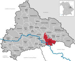
Location of Bad Kötzting within Cham district | |
| Coordinates: 49°10′37″N 12°51′18″E / 49.17694°N 12.85500°E | |
| Country | Germany |
| State | Bavaria |
| Admin. region | Upper Palatinate |
| District | Cham |
| Subdivisions | 51 |
| Government | |
| • Mayor | Markus Hofmann (FW) |
| Area | |
| • Total | 62.18 km2 (24.01 sq mi) |
| Elevation | 409 m (1,342 ft) |
| Population (2022-12-31)[1] | |
| • Total | 7,466 |
| • Density | 120/km2 (310/sq mi) |
| Time zone | UTC+01:00 (CET) |
| • Summer (DST) | UTC+02:00 (CEST) |
| Postal codes | 93444 |
| Dialling codes | 0 99 41 |
| Vehicle registration | CHA, KÖZ, ROD, WÜM |
| Website | www |
Bad Kötzting (before 2005: Kötzting) is a town of the district of Cham, in Bavaria, Germany.
References[change | change source]
- ↑ Genesis Online-Datenbank des Bayerischen Landesamtes für Statistik Tabelle 12411-003r Fortschreibung des Bevölkerungsstandes: Gemeinden, Stichtag (Einwohnerzahlen auf Grundlage des Zensus 2011)
Other websites[change | change source]
![]() Media related to Bad Kötzting at Wikimedia Commons
Media related to Bad Kötzting at Wikimedia Commons
- Official website (in German)


