Bennekom
Bennekom | |
|---|---|
Village | |
 Surroundings of Bennekom | |
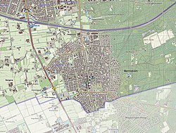
 Map of Bennekom | |
| Country | |
| Province | |
| Municipality | Ede |
| Population (2020)AlleCijfers.nl | |
| • Total | 15,150 |
| Time zone | UTC+1 (CET) |
| • Summer (DST) | UTC+2 (CEST) |
| Postal code | 6720-6721 |
| Telephone area | 0318 |
Bennekom (Low Saxon: Bennekum) is a village in the municipality of Ede, province of Gelderland, the Netherlands.
From 1812 to 1818 Bennekom also was a municipality.
About 15,000 people live in this village.
Bennekom lies south of the A24 motorway, and between the city of Ede in the north and the town of Wageningen in the south.
References[change | change source]

