
Bloomingdale, Tennessee
Bloomingdale, Tennessee | |
|---|---|
 Location of Bloomingdale, Tennessee | |
| Coordinates: 36°34′41″N 82°30′23″W / 36.57806°N 82.50639°W | |
| Country | United States |
| State | Tennessee |
| County | Sullivan |
| Area | |
| • Total | 9.88 sq mi (25.59 km2) |
| • Land | 9.88 sq mi (25.59 km2) |
| • Water | 0.00 sq mi (0.00 km2) |
| Elevation | 1,440 ft (439 m) |
| Population | |
| • Total | 8,918 |
| • Density | 902.63/sq mi (348.51/km2) |
| Time zone | UTC-5 (Eastern (EST)) |
| • Summer (DST) | UTC-4 (EDT) |
| ZIP code | 37660 |
| Area code | 423 |
| FIPS code | 47-06640[3] |
| GNIS feature ID | 1277714[4] |
Bloomingdale is a census-designated place (CDP) in Sullivan County, Tennessee, United States. The population was 8,918 at the 2020 census.[5] It is part of the Kingsport–Bristol (TN)–Bristol (VA) Metropolitan Statistical Area, which is a component of the Johnson City–Kingsport–Bristol, TN-VA Combined Statistical Area – commonly known as the "Tri-Cities" region.
Geography[change | change source]
Bloomingdale is located at 36°34′41″N 82°30′23″W / 36.578067°N 82.506291°W.[6]
According to the United States Census Bureau, the CDP has a total area of 10.0 square miles (26 km2), all of it land.
As of the 2020 United States census, there were 8,918 people, 3,977 households, and 2,449 families residing in the CDP.
References[change | change source]
- ↑ "ArcGIS REST Services Directory". United States Census Bureau. Retrieved October 15, 2022.
- ↑ "Census Population API". United States Census Bureau. Retrieved Oct 15, 2022.
- ↑ "U.S. Census website". United States Census Bureau. Retrieved 2008-01-31.
- ↑ "US Board on Geographic Names". United States Geological Survey. 2007-10-25. Retrieved 2008-01-31.
- ↑ "QuickFacts: Bloomingdale CDP, Tennessee". United States Census Bureau. Retrieved March 18, 2024.
- ↑ "US Gazetteer files: 2010, 2000, and 1990". United States Census Bureau. 2011-02-12. Retrieved 2011-04-23.
Municipalities and communities of Sullivan County, Tennessee, United States | ||
|---|---|---|
| Cities | 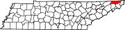 | |
| CDPs | ||
| Other communities | ||
| Footnotes | ‡This area also has part of it in an connecting county or counties | |