Buenaventura, Valle del Cauca
Buenaventura | |
|---|---|
Municipality and town | |
| Nickname: El Puerto (the Port) | |
 Location of the municipality and town of Buenaventura, Colombia in the Valle del Cauca Department of Colombia. | |
| Coordinates: 3°52′38″N 77°1′36″W / 3.87722°N 77.02667°W | |
| Country | |
| Department | Valle del Cauca Department |
| Region | Pacific Region of Colombia |
| Regional District | Special economic zone district |
| Foundation | 14 July 1540 |
| Founded by | Juan Ladrillero by order from Pascual de Andagoya |
| Government | |
| • Mayor | Víctor Hugo Vidal Piedrahíta |
| • City Council | List of Councillors |
| Area | |
| • Total | 6,078 km2 (2,347 sq mi) |
| Highest elevation | 7 m (23 ft) |
| Lowest elevation | 0 m (0 ft) |
| Population (2019 estimate[1]) | |
| • Total | 432,385 |
| • Rank | Ranked 19th |
| • Density | 71/km2 (180/sq mi) |
| Demonym(s) | Porteño, Bonaverense |
| Time zone | UTC-5 (Colombia Standard Time) |
| Area code | 224 |
| Website | www |
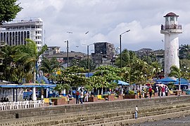
Buenaventura is a coastal seaport city in the department of Valle del Cauca, Colombia (South America). Buenaventura (Spanish for "good fortune") is the main port of Colombia in the Pacific Ocean.[2]
The city is part of the UNESCO Creative Cities Network after it was named "City of Gastronomy" in 2017.[3]
References[change | change source]
- ↑ "Resultados y proyecciones (2005-2020) del censo 2005" (in Spanish). Retrieved 1 July 2019.
- ↑ Kraul, Chris (21 September 2009). "Colombian crackdown appears to be paying off". Retrieved 19 April 2018 – via LA Times.
- ↑ "Once Colombia's 'Deadliest City,' Buenaventura Is Coming Back". Retrieved 2018-10-03.


