
Draguignan
Draguignan | |
|---|---|
 City theater, Draguignan | |
 Coat of arms | |
Location of Draguignan  | |
 Draguignan  Draguignan | |
| Coordinates: 43°32′25″N 6°28′00″E / 43.5403°N 6.4667°E | |
| Country | France |
| Region | Provence-Alpes-Côte d'Azur |
| Department | Var |
| Arrondissement | Draguignan |
| Canton | Draguignan |
| Intercommunality | Draguignan |
| Government | |
| • Mayor (2014-2020) | Richard Strambio |
| Area 1 | 53.8 km2 (20.8 sq mi) |
| Population (2013) | 39,174 |
| • Density | 730/km2 (1,900/sq mi) |
| Demonym | Dracénois |
| Time zone | UTC+01:00 (CET) |
| • Summer (DST) | UTC+02:00 (CEST) |
| INSEE/Postal code | 83050 /83300 |
| Elevation | 153–603 m (502–1,978 ft) (avg. 376 m or 1,234 ft) |
| Website | www.ville-draguignan.fr/ |
| 1 French Land Register data, which excludes lakes, ponds, glaciers > 1 km2 (0.386 sq mi or 247 acres) and river estuaries. | |
Draguignan (Occitan: Draguinhan) is a commune in the Var department in the Provence-Alpes-Côte d'Azur region, in southeastern France.
It is a subprefecture of the department.
History[change | change source]
Draguignan became the prefecture of the Var in 1797, at the beginning of the French Revolution. This was even if the town was not the biggest city in the department. It remained as the prefecture until 1974 when it was moved to Toulon.[1]
Geography[change | change source]
The city is at the foot of the Malmont mountain, in a valley that is about 2 km (1.2 mi) long, from northwest to southeast. The Nartuby, a tributary of the Argens river, flows to the west of the city.
Draguignan has an area of 53.8 km2 (20.8 sq mi),[2] and its average altitude is 376 m (1,234 ft); at the city hall, the altitude is 200 m (660 ft).[3]

|
Draguignan is surrounded by the communes Saint-Rémy, Maleville, La Bastide-l'Évêque, Morlhon-le-Haut, Sanvensa, La Rouquette, Savignac and Toulonjac.
Places next to Draguignan | |
|---|---|
Climate[change | change source]
The climate of Draguignan, in the Köppen climate classification, is Csb - Mediterranean climate with template summers.
Population[change | change source]
With a population in 2013 of 39,174,[2] Draguignan has a population density is of 728.1 inhabitants/km2.
The inhabitants of Draguignan are known, in French, as Dracenois (women: Dracenoises).[4]
Sister cities[change | change source]
Draguignan is twinned with:
Gallery[change | change source]
-
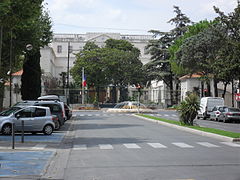 Subprefecture of Draguignan
 -
 Malmont mountain
 -
 Chapelle de l'Observance, Draguignan
 -
 Chapelle des Minimes and convent, Draguignan


.jpg)
References[change | change source]
- ↑ "Historique du Var". Le SPLAF (in French). Retrieved 26 November 2016.
- ↑ 2.0 2.1 "Comparateur de territoire - Commune de Draguignan (83050)" (in French). Institut national de la statistique et des études économiques - INSEE. Retrieved 26 November 2016.
- ↑ "Draguignan". Map-France.com. Retrieved 27 November 2016.
- ↑ "Var" (in French). habitants.fr. Retrieved 27 November 2016.
Related pages[change | change source]
Other websites[change | change source]
- Mairie de Villefranche-de-Rouergue - Official website Archived 2011-05-25 at the Wayback Machine (in French)