Fendalton

Coordinates: 43°31′S 172°36′E / 43.517°S 172.600°E / -43.517; 172.600
From Simple English Wikipedia, the free encyclopedia


Fendalton
Punting at Mona Vale, a prominent park and former homestead in Fendalton.
Map
Coordinates: 43°31′S 172°36′E / 43.517°S 172.600°E / -43.517; 172.600
CountryNew Zealand
CityChristchurch
Local authorityChristchurch City Council
Electoral wardFendalton
Community board
  • Waimāero Fendalton-Waimairi-Harewood
  • Waipuna Halswell-Hornby-Riccarton
Established1850
Area
 • Land217 ha (536 acres)
Population
 (June 2023)[2]
 • Total4,550
Postcode(s)
8052

Fendalton

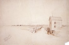
Daniel Inwood's flour mill in Fendalton, 1853

Fendalton is a suburb of Christchurch. It is one of the oldest suburbs of Christchurch and has two schools and one high school Christchurch Boy's High school. It is situated near the suburbs of Riccarton, Bryndwr, Merivale and Ilam.

References[change | change source]

  1. Cite error: The named reference Area was used but no text was provided for refs named (see the help page).
  2. "Population estimate tables - NZ.Stat". Statistics New Zealand. Retrieved 25 October 2023.