
Garland, Arkansas
Garland, Arkansas | |
|---|---|
 Location in Miller County, Arkansas | |
| Coordinates: 33°21′44″N 93°42′54″W / 33.36222°N 93.71500°W | |
| Country | United States |
| State | Arkansas |
| County | Miller |
| Area | |
| • Total | 0.88 sq mi (2.27 km2) |
| • Land | 0.88 sq mi (2.27 km2) |
| • Water | 0.00 sq mi (0.00 km2) |
| Elevation | 226 ft (69 m) |
| Population | |
| • Total | 195 |
| • Density | 222.35/sq mi (85.86/km2) |
| Time zone | UTC-6 (Central (CST)) |
| • Summer (DST) | UTC-5 (CDT) |
| ZIP Code | 71839 |
| FIPS code | 05-25780 |
| GNIS feature ID | 0076999 |
Garland is a small town in Miller County, Arkansas, United States.
References[change | change source]
- ↑ "2021 U.S. Gazetteer Files: Arkansas". United States Census Bureau. Retrieved June 2, 2022.
- ↑ "P1. Race – Garland town, Arkansas: 2020 DEC Redistricting Data (PL 94-171)". U.S. Census Bureau. Retrieved June 2, 2022.
Municipalities and communities of Miller County, Arkansas, United States | ||
|---|---|---|
| Cities | 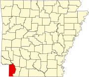 | |
| Town | ||
| CDP | ||
| Other unincorporated communities | ||