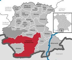
Garmisch-Partenkirchen
Garmisch-Partenkirchen | |
|---|---|
 Garmisch-Partenkirchen with Alpspitze and Zugspitze in September 2009 | |
| Coordinates: 47°30′N 11°5′E / 47.500°N 11.083°E | |
| Country | Germany |
| State | Bavaria |
| Admin. region | Oberbayern |
| District | Garmisch-Partenkirchen |
| Government | |
| • Mayor | Thomas Schmid (Chr.Soziales Bündnis/Bürger für GAP e.V.) |
| Area | |
| • Total | 205.66 km2 (79.41 sq mi) |
| Elevation | 708 m (2,323 ft) |
| Population (2022-12-31)[1] | |
| • Total | 27,482 |
| • Density | 130/km2 (350/sq mi) |
| Time zone | UTC+01:00 (CET) |
| • Summer (DST) | UTC+02:00 (CEST) |
| Postal codes | 82467 |
| Dialling codes | 08821 |
| Vehicle registration | GAP |
| Website | www |
Garmisch-Partenkirchen is a mountain resort town in Bavaria in southern Germany. It is the administrative centre of the district of Garmisch-Partenkirchen, in the Oberbayern region, and the district is on the border with Austria. Nearby is Germany's highest mountain, Zugspitze, at 2,961 metres (9,715 feet). The Olympic Winter Games were held here in 1936.
References[change | change source]
- ↑ Genesis Online-Datenbank des Bayerischen Landesamtes für Statistik Tabelle 12411-003r Fortschreibung des Bevölkerungsstandes: Gemeinden, Stichtag (Einwohnerzahlen auf Grundlage des Zensus 2011)
Other websites[change | change source]
![]() Media related to Garmisch-Partenkirchen at Wikimedia Commons
Media related to Garmisch-Partenkirchen at Wikimedia Commons
- gapa.de[permanent dead link] - official website (in English)


